
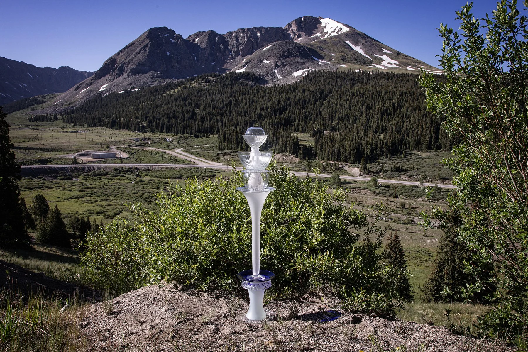
Leadville, Colorado, June 30, 2025
39°21'47"N 106°10'48"W, Elevation 11,180 feet
Looking across the valley and stone quarry toward Quandary Peak and the springs and creek that become the Arkansas River. Because the land on this mountain is private property, we were not able to find the initial spring or creek. Earlier explorers also found it difficult to identify the river’s origin. Because of the extreme cold in January 1845, John Charles Fremont’s party was not able reach the river’s source. They were out of food and had used their blankets to make shoes and ended their search at 39°20'38"N 106°27'15"W. Google Earth shows the river going farther north, joining the east Fork of Homestake Creek, adjacent to the contemporary Homestake Reservoir.
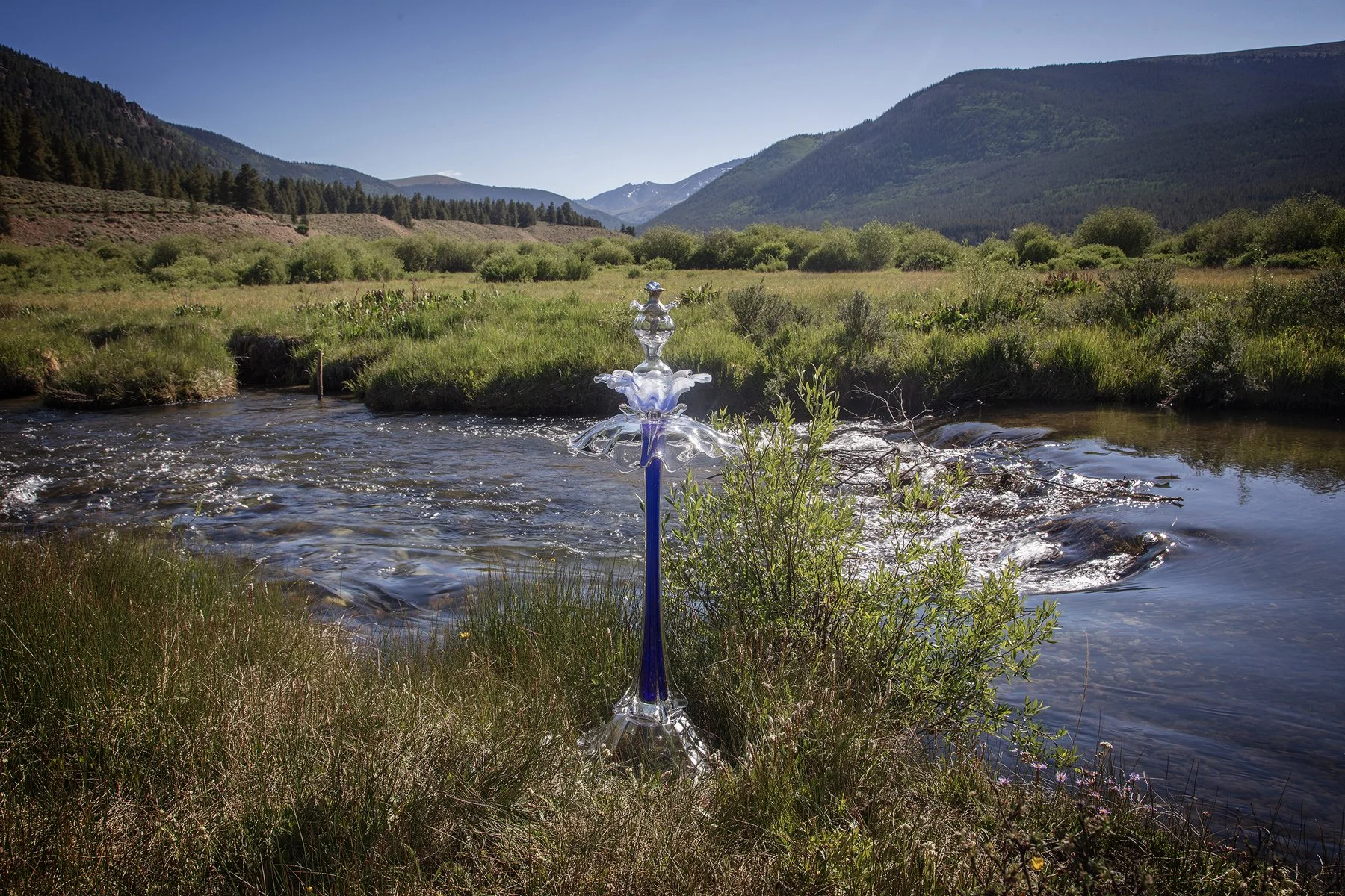
Crystal River Road, Leadville, Colorado, June 30, 2025
39°16'25"N 106°17'49"W, Elevation 9,980 feet
The two people fishing in the young Arkansas River were unconcerned with the blue Splash cairn that appeared briefly in the cold water.
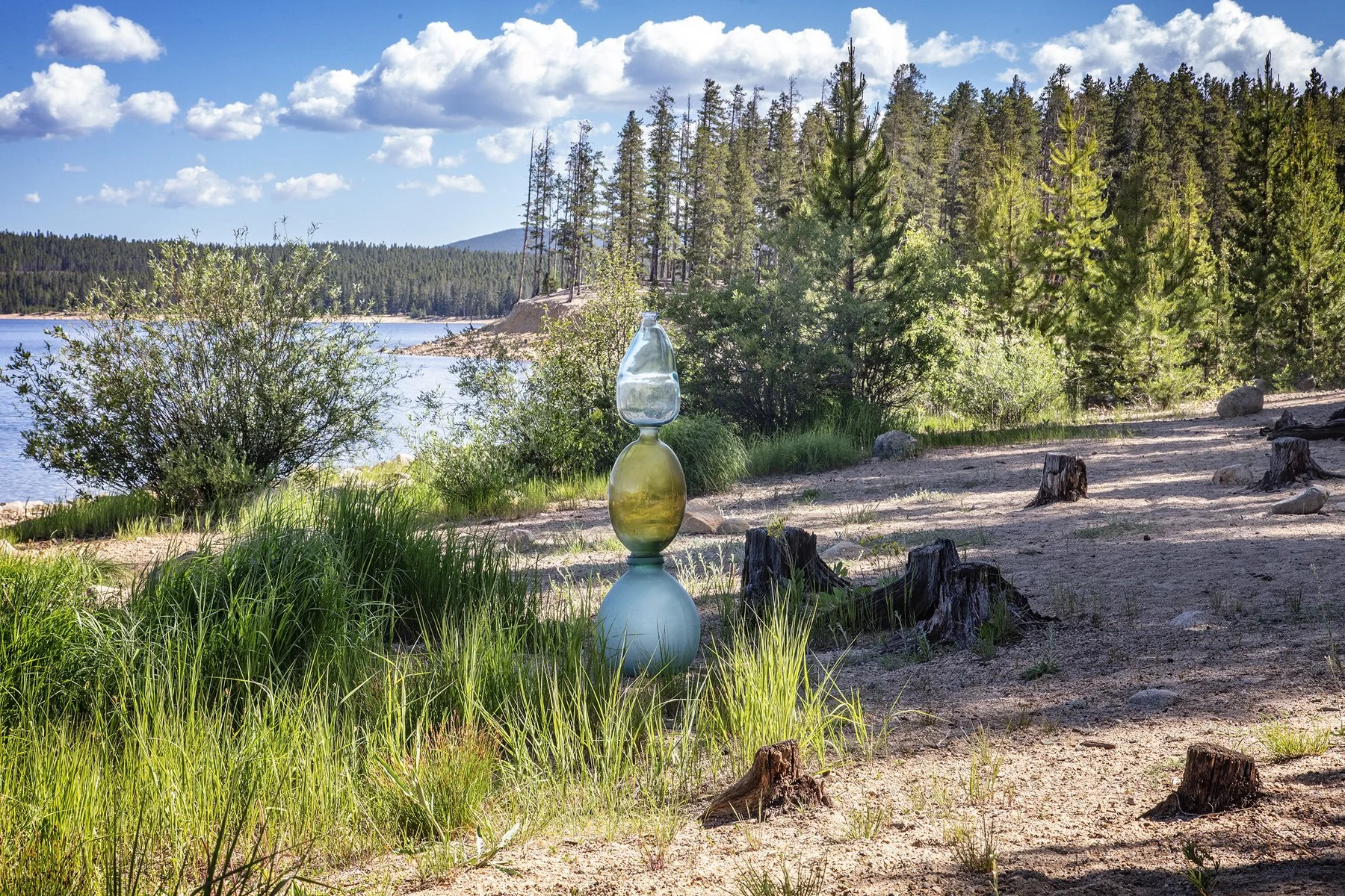
Turquoise Lake Road, Turquoise Lake Recreational Area, San Isabel National Forest, Leadville, Colorado, June 30, 2025
39°15'31"N 106°21'37"W, Elevation 9,880 feet
Three large stacked jugs balanced temporarily on the eastern edge of Turquoise Lake, less than a mile west of the confluence of the East Fork of the Arkansas River and Tennessee Creek. Wikipedia lists this confluence 39°15'30"N 106°20'38"W as the origin of the Arkansas River.
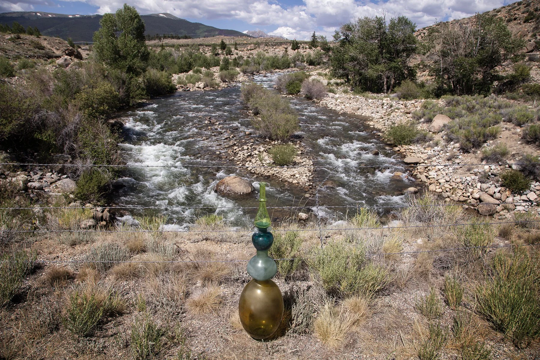
Off Highway 24 south of Leadville, Colorado, June 30, 2025
39°04'39"N 106°16' 55"W, Elevation 9,040 feet
This cairn rests on the Highway 24 bridge looking east toward the South Peak of the Collegiate Range, a section of the Sawatch Range of the Rocky Mountains.
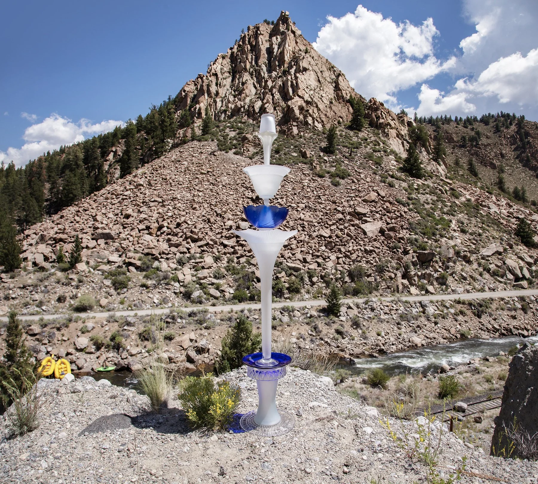
Browns Canyon National Monument, Scenic Byway, Highway 300, north of Nathrop, Colorado, June 30, 2025
39°45'01"N 106°04'01"W, Elevation 8,760 feet
Trumpet Cairn sits on the edge of the bluff overlooking the Arkansas River’s parade of yellow raft. As in this photo, roads and railroad tracks run alongside most of the river. The large rock on the track is unusual, however.

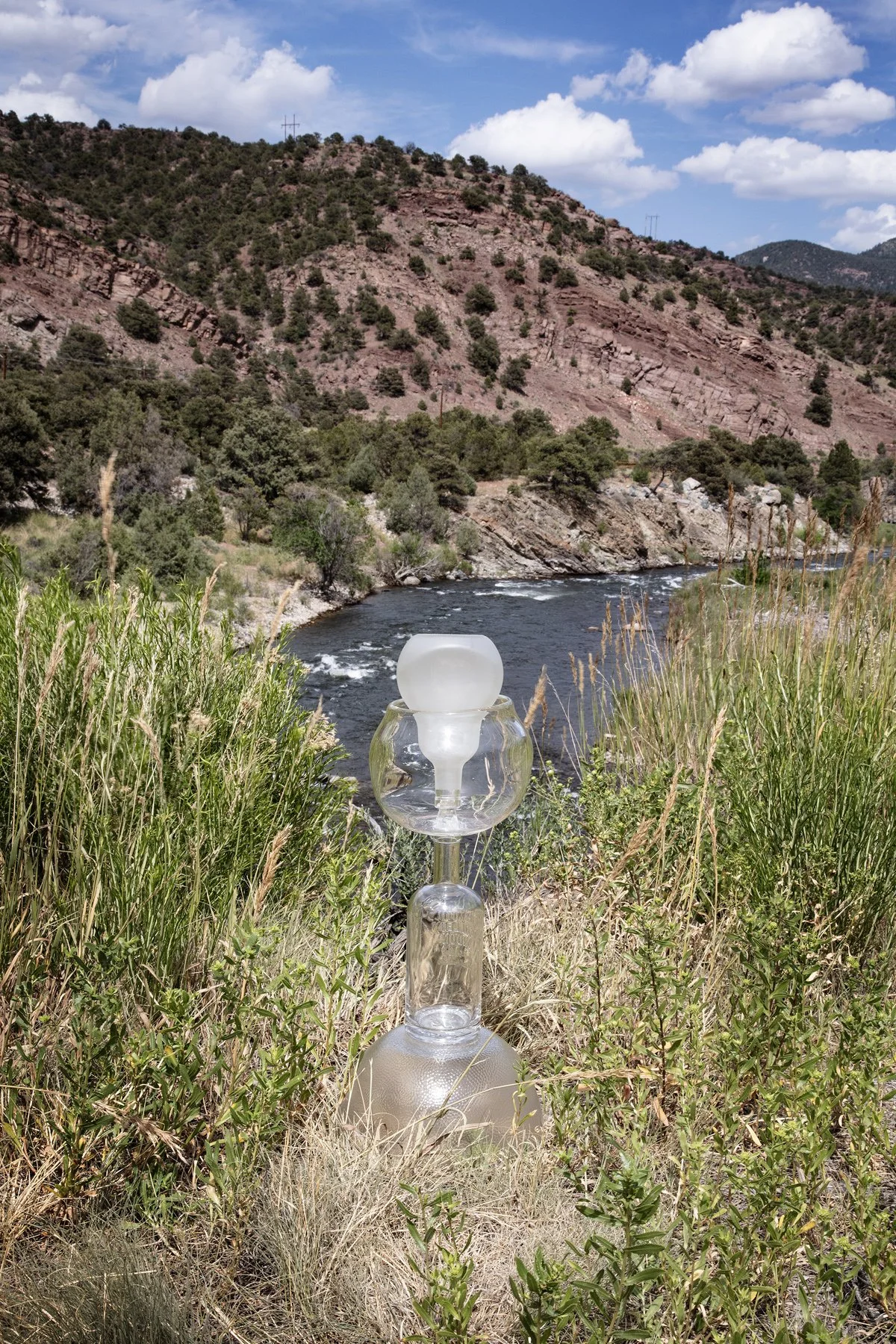
Near Hecla Junction Campground, Browns Canyon National Monument, Highway 194, south of Nathrop, Colorado, June 30, 2025
39°09'16"N 106°14'01"W, Elevation 7,390 feet
Clouds and light rain at the foot of Sugarloaf Mountain provides the setting for a green jug and clear-glass bowl cairn.
Hecla Campground, Off Highway 50, Wellsville, Colorado, June 30, 2025
38°28'32"N 105°53'11"W, Elevation 6,850 feet
A historic marker indicated that explorer Zebulon Montgomery Pike, wrote in his journal during his 1906-07 trip down the Arkansas River, that this was the place they redistributed their packs and saw a new bird.
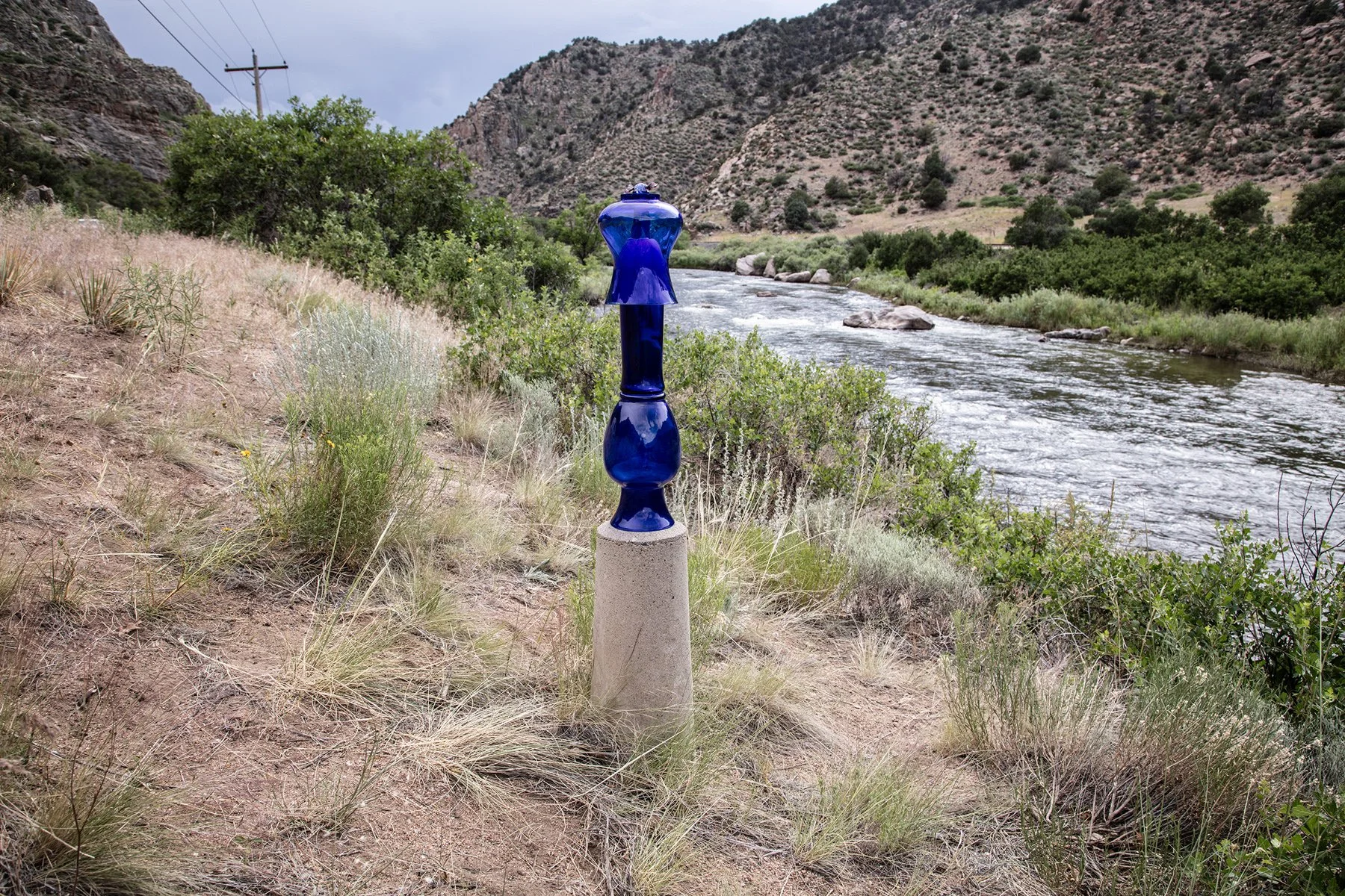
Off Highway 50 near the AHRA Canyon Trading Post Recreation Site, Cotopaxi, Colorado
38°21'57"N 105°43'06"W, Elevation 6,420 feet
A blue cairn is posed on a concrete post. A metal badge on the top of the post reads ROW (Right of Way in the construction of Highway 50) Colorado Highway Department.
Garden Street and Riverside Avenue, Cañon City, Colorado, July 1, 2025
38°26'01"N 105°15'17"W, Elevation 5,380 feet
A plaque near this bridge honors the memory of John Greenleaf Nichols who served the Cañon City parks department from 1974 to 2008 and was responsible for the city’s excellent park system. The Arkansas Riverwalk Trail and Tunnel Drive Trailhead are connected by this bridge over the Arkansas River.
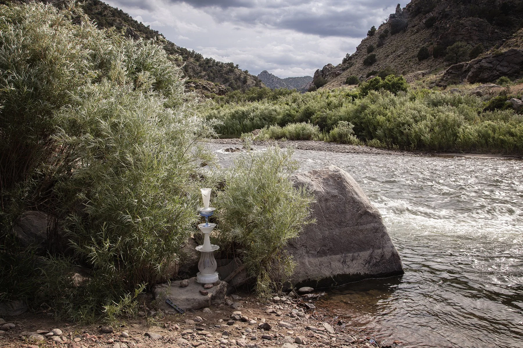
Coyote Run Road, Highway 50, Sawmill Gulch, Colorado, June 30, 2025
38°21'51"N 105°31'23"W, Elevation 6,070 feet
A chance to get close to the river, this popular fishing spot was the temporary home for this glass cairn, assembled from repurposed glass, some glued to join multiple pieces, filling the artists’ van. The base piece, the globe of a hanging light fixture, is shimmed with rocks found at the site. As additional pieces are stacked on it, they are checked to be sure they are level and secured with adhesives, if it’s particularly windy.
June 30, 2025
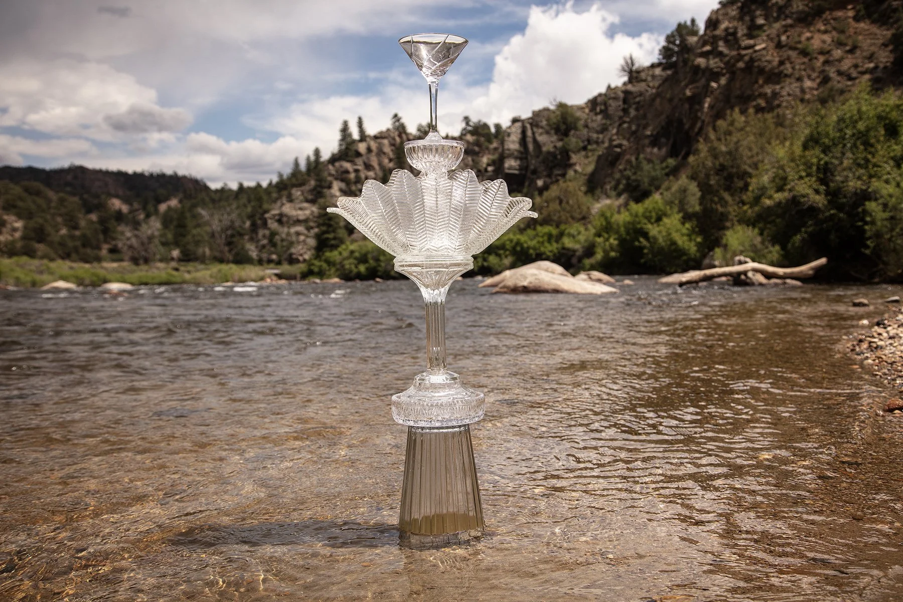
Highway 285 Hecla Junction Campground, Browns Canyon National Monument,, North of Salida, Colorado, June 30, 2025
38°39'15"N 106°03'14"W, Elevation 7,390 feet
The New Crystal cairn rests in bubbling Arkansas River water.
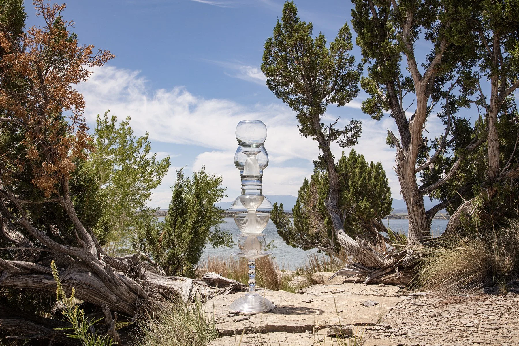
Sailboat Road off Juniper Road, Lake Pueblo State Park, Pueblo, Colorado, July 1, 2025
38°16'33"N 104°44'09"W, Elevation 4,890 feet
This arid park adjacent to the reservoir was created by the construction of the Pueblo Dam. The farming community of Swallows was located where the reservoir now fills the valley. In 1921 the community was seriously damaged by flooding. Then in the 1970s, the town was demolished to build the dam operated by the US Army Corps of Engineers for flood control
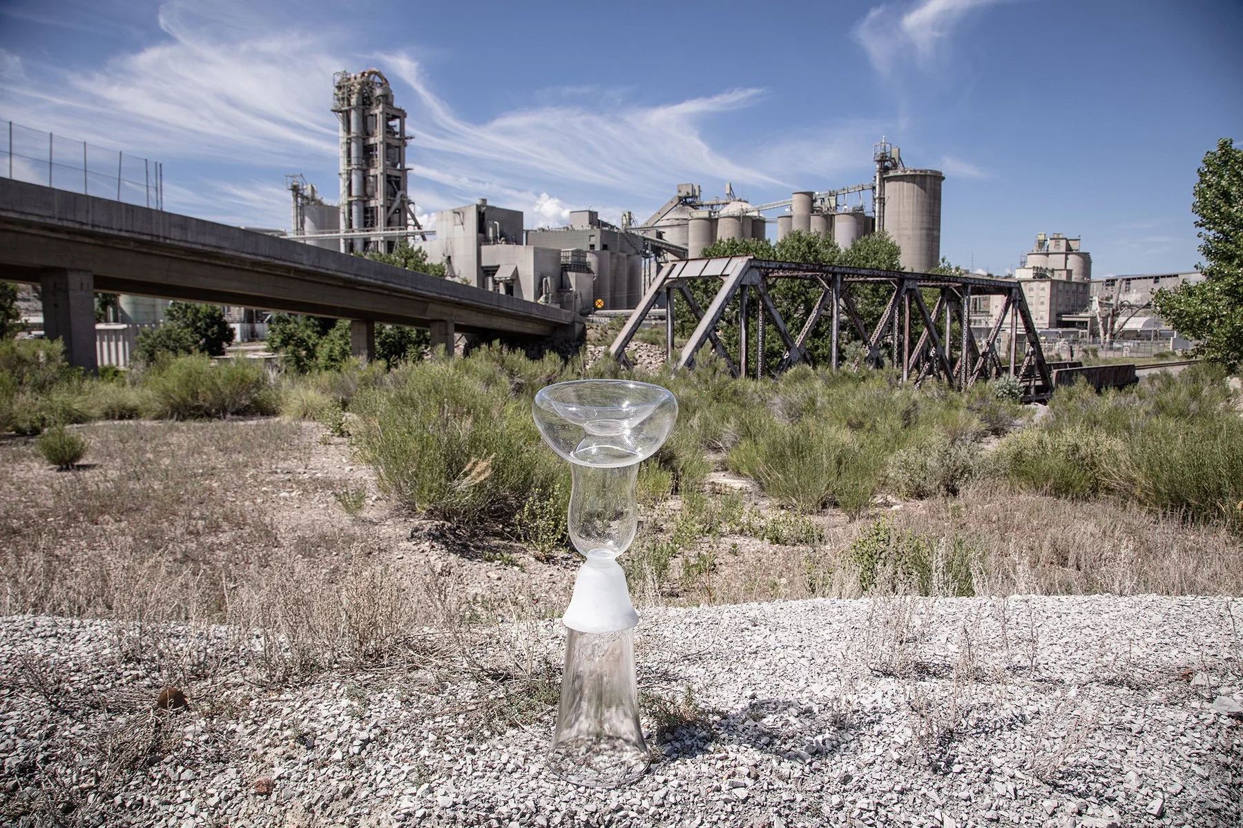
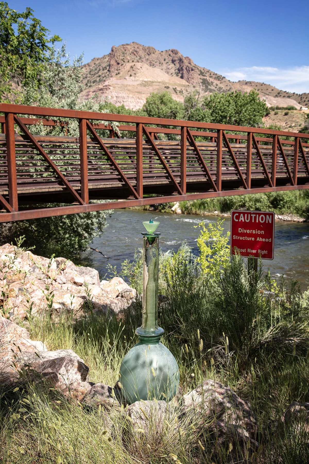
Highway 120, Penrose, Colorado, July 1, 2025
38°23'20"N 105°0'56"W, Elevation 5,080 feet
A play on the usual cairns built from rocks found at rivers and lakes, this “wonky” clear and satin glass cairn rests on a crushed rock pile outside an expansive rock quarry. On the other side of Highway 120 and the Arkansas River is a massive Portland cement factory. In 2018, the US Geological Survey estimated the value of sand and gravel quarried in the state of Colorado was $284 million and $141 million for crushed stone.
County Road 4S, off highway 50, Fowler, Colorado, July 1, 2025
38°07'56"N 103°59'42"W, Elevation 4,310 feet
This is another canal south of the Arkansas River. The canals are parallel to the Arkansas River, diverting river water to irrigate agricultural fields. Wikipedia states: “Water flow in the Arkansas River (as measured in central Kansas) has dropped from approximately 248 cubic feet per second (7.0 m3/s) average from 1944–1963 to 53 cubic feet per second (1.5 m3/s) average from 1984–2003, largely because of the pumping of groundwater for irrigation in eastern Colorado and western Kansas.”
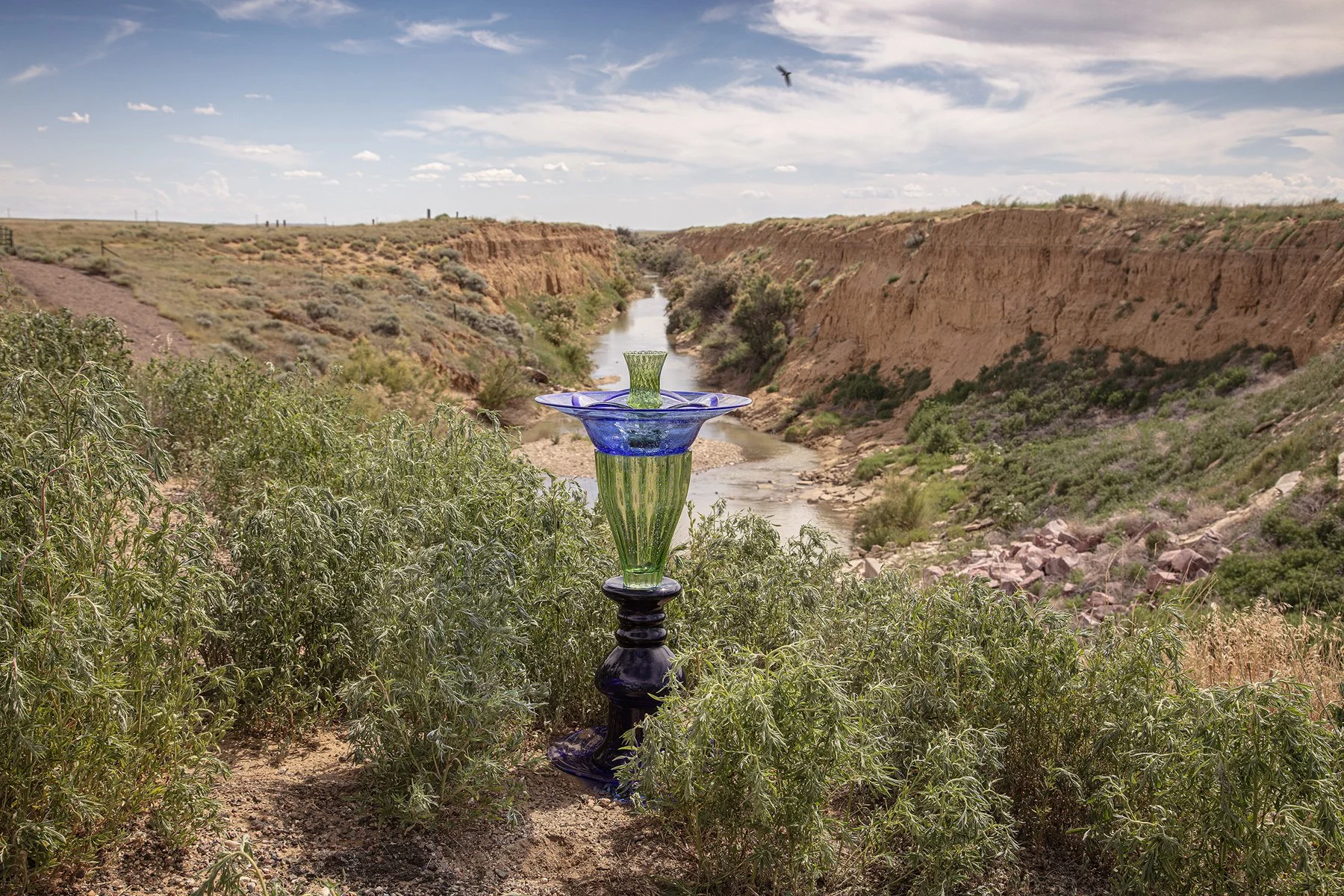
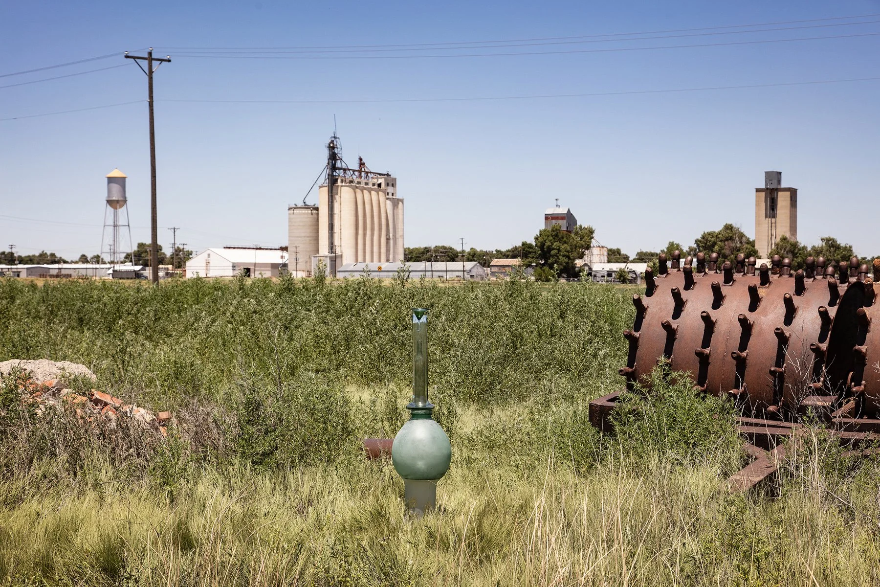
Highway 96, Ordway County, Colorado, July 1, 2025
38°08'52"N 103°44' 54"W, Elevation 4,280 feet
A green cairn and a nearby sign warning “No Swimming, Strong Undertow” mark this canal that takes water from the Lake Meredith Reservoir for irrigation. Its path roughly parallels the Arkansas River and creates a rich agricultural valley. This site is near the reconstructed fort at the Bent’s Old Fort National Historic site. The fort was built in 1833 to trade with Native Americans and trappers. It became an important stop on the Santa Fe Trail as wagon trains of settlers moved west.
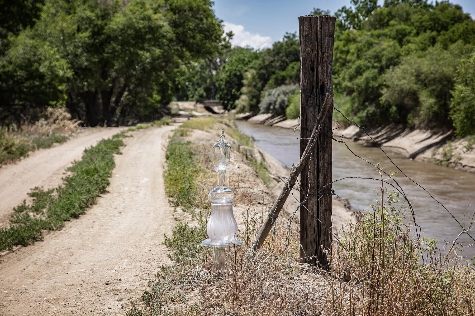
South Russell Avenue off Highway 96, Boone, Colorado, July 1, 2025
38°14'47"N 104°15'22"W
Elevation 4,470 feet
The Colorado Canal takes water from the very curvy Arkansas River at Madison Road and directs it in a straight path parallel to Highway 96, reconnecting the river downstream at the Nepesta Bridge in Fowler, Colorado. The glass bird inside this clear-glass cairn is a nod to the flock of small black birds that were swooping above the canal while we were setting up. Unfortunately, they didn’t hang around for the photo.
North Gateway Park, Lamar, Colorado, July 2, 2025
38°06'22"N 102°36'16"W, Elevation 3,610 feet
This community park features several ponds with many fishing stations, shaded picnic tables, volley ball nets, and a swimming area on the Arkansas River.
A roadrunner bird crossed the road ahead of our van as we drove around the park.
John Martin Reservoir State Park, Hasty, Colorado, July 1, 2025
38°04'10"N 102°57'49"W, Elevation 3,860 feet
Construction of the John Martin Dam and Reservoir, used for flood control, irrigation, and recreation, was completed in 1948. It is surrounded by the John Martin Reservoir State Park. That same year, the states of Colorado and Kansas signed the Arkansas River Compact, agreeing to the two states allotment of Arkansas River water, including water held in this reservoir. In 1980, the states developed a plan to allocate 60% of the reservoir’s water to Colorado and 40% to Kansas. The implementation of this agreement has been the source of an ongoing battle in the courts.
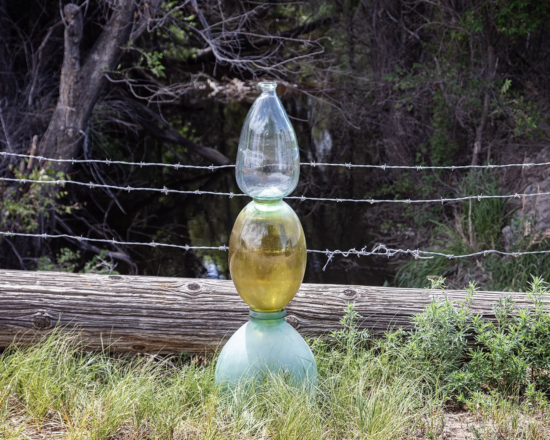
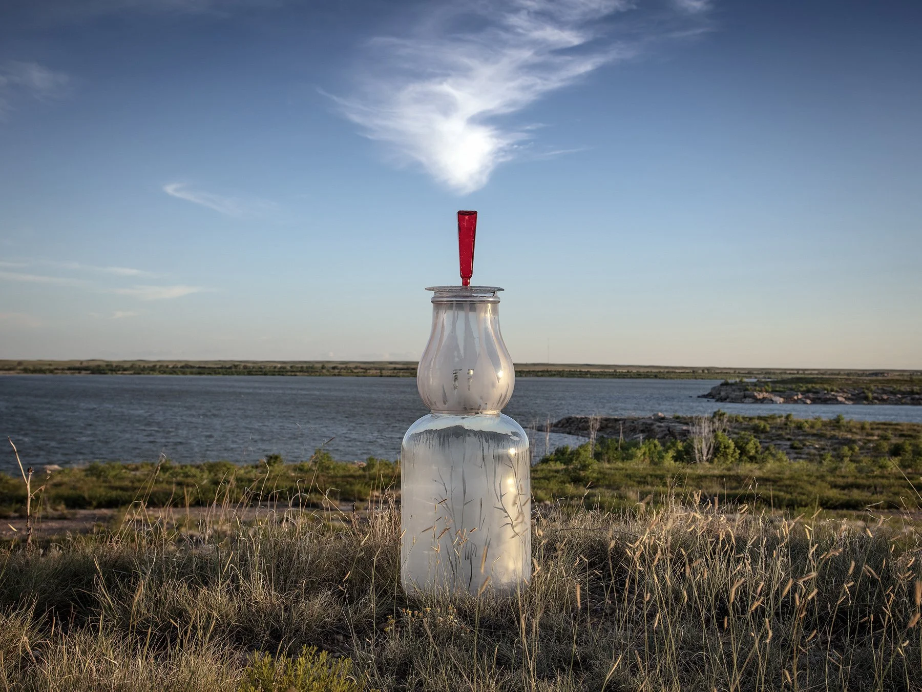
Highway 89, Holly, Colorado, July 2, 2025
38°02'43"N 102°07'02"W, Elevation 3,390 feet
A Big Jug Cairn rests near agricultural equipment on the bank of the Arkansas River. Looking toward the small town of Holly (2020 census reported 837 people), this site is four miles west of Colorado’s boarder with Kansas. A sign welcoming visitors to Holly announces that Roy Romer, Colorado Governor, 1987–1999, had lived here.
West Canal Road and Jachim Street, La Junta, Colorado, July 1, 2025
38°0'17"N 103°32'58"W, Elevation 4,080 feet
This spillway is on a canal that supplies irrigation water to a grid of green fields between the canal and the main branch of the Arkansas River, a mile to the south. The surrounding land, not supplied by tributaries or canals, is not as productive.
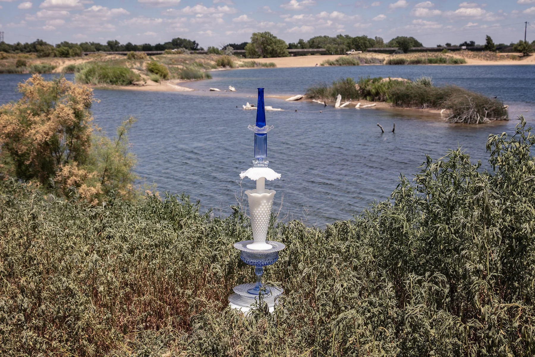
Syracuse Sand Dunes Park, Highway 27, Syracuse, Kansas, July 2, 2025
37°57'50"N 101°45'44"W, Elevation 3,220 feet
Is it called mining when sand is scooped for sale? This pond and dune buggy recreation area was at the edge of a larger sand excavation site.
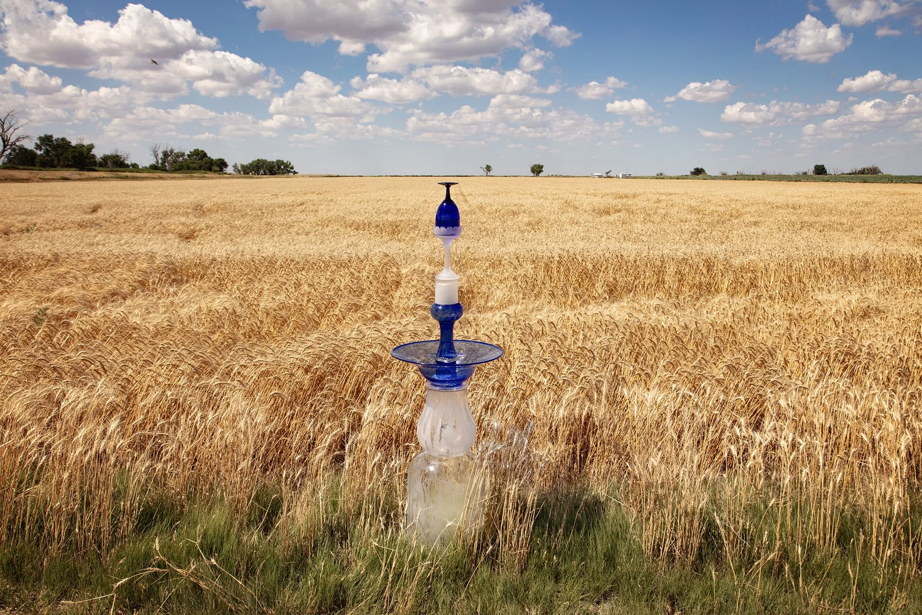
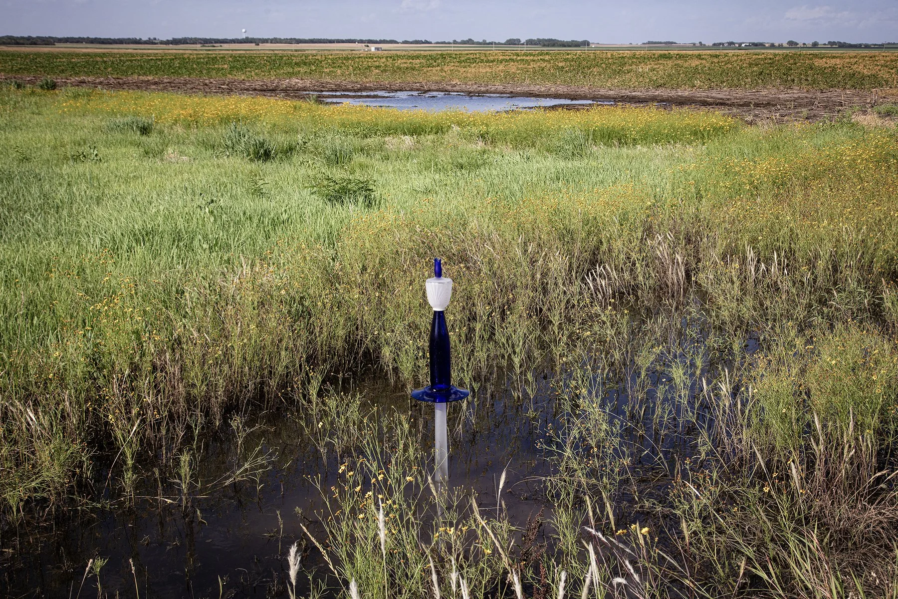
Intersection of Roads W2 and 180, Deerfield, Kansas, July 2 ‘25
37°57'50"N 101°45'44"W, Elevation 3,020 feet
Miles of industrial-scale fields of corn, soy beans, and wheat fill the land adjacent to the Arkansas River, blocking access to the river but providing a golden backdrop for this blue cairn. There is very little traffic on these gravel roads between the fields. To our surprise, as we were placing this cairn, two trucks came down the road. When Josh moved the van so they could pass, they waved, smiled, and drove on.
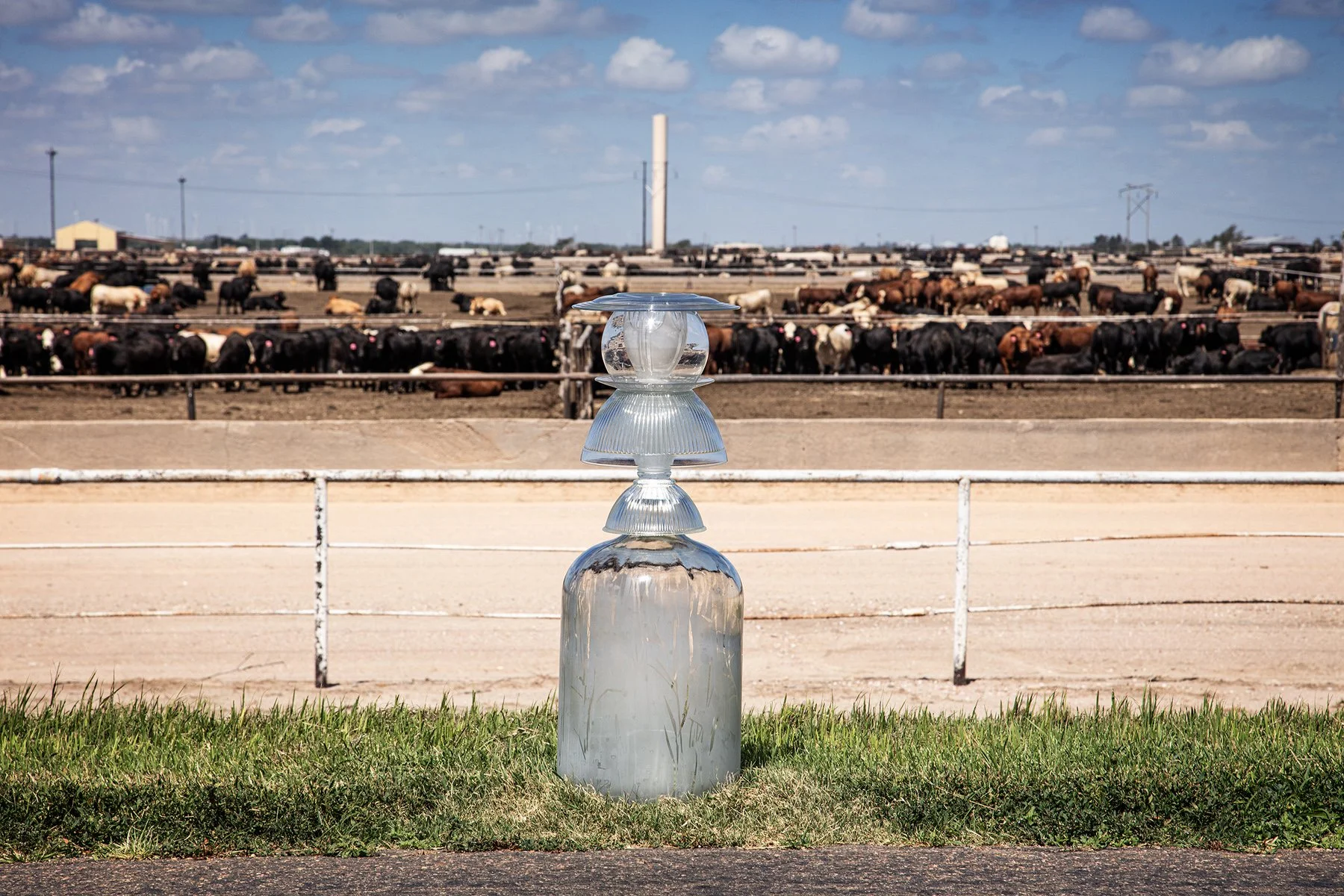
Ford, Kansas, July 3, 2025
37°40'09"N 99°44'32"W, Elevation 2,420 feet
This confined animal operation, CAFO, is huge, holding thousands of cows in pens of about twenty cows each. A man on a frontend loader was moving from pen to pen scooping their manure into a mound in the middle. In three of the pens, black angus cows were standing on the top of their mound. In one pen, a light tan cow lay on its side on the top of the mound, apparently dead.
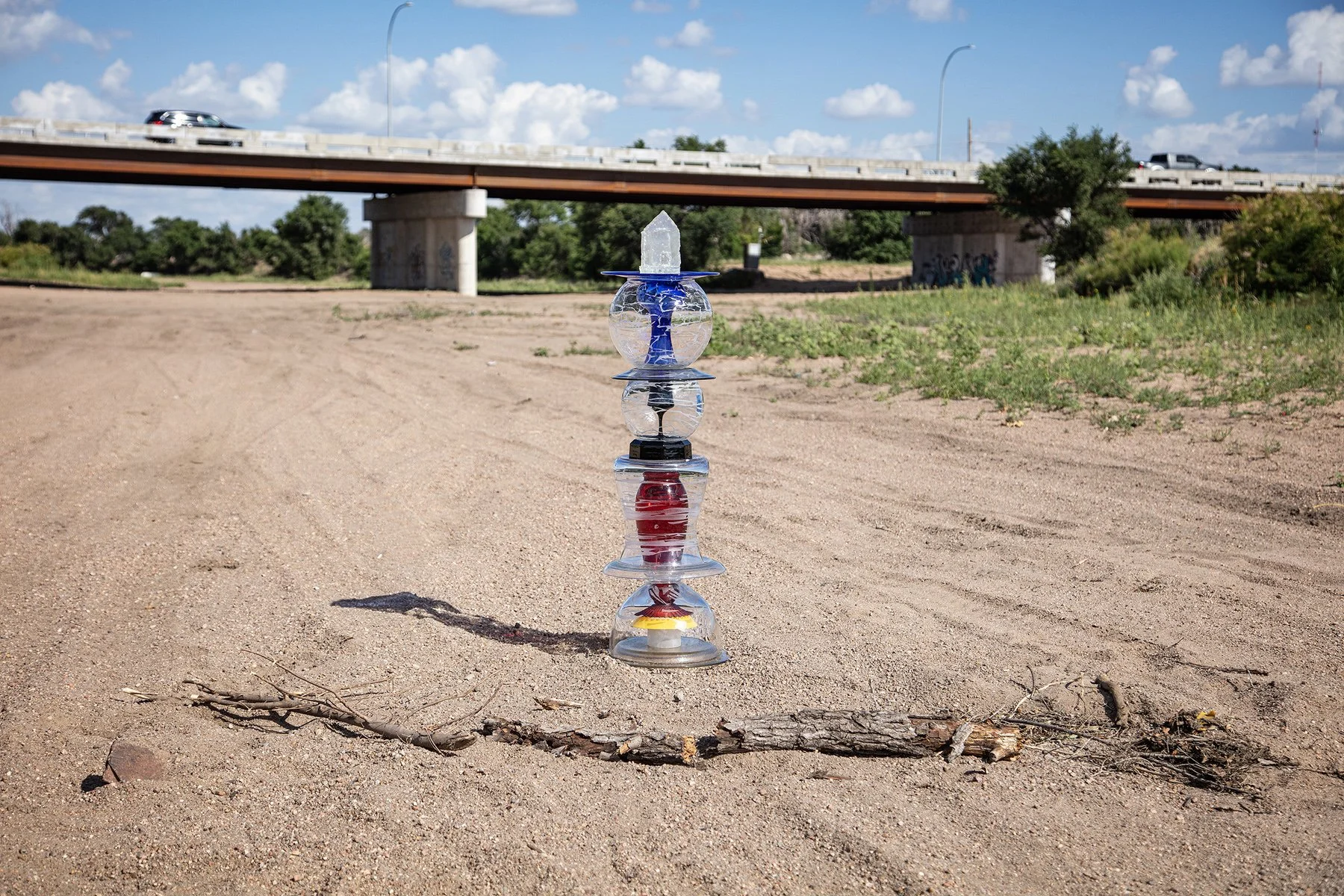
Looking toward the Highway 83 bridge over the Arkansas River, Garden City, Kansas, July2, 2025
37°57'22"N 100°52'43"W, Elevation 2,830 feet
The Arkansas River flows over the Ogallala Aquifer at this location. The aquifer, a massive pool of ancient fresh water deep underground, is being depleted by wells drawing water, primarily for irrigation. The cairn’s stacked spheres conceptualize the various layers of the earth’s structure: glowing core; a layer of coal, oil, or carbon sequestration. A Blue plate represents groundwater such as rivers, lakes, and wetlands. The cast glass house on top represents human constructions on the surface of the planet.
According to the Fourth National Climate Assessment (NCA4) 2017/2018, water is being pumped from this aquifer faster than it is being replenished. A map published by the US National Oceanic and Atmospheric Agency, shows the aquifer below Garden City, Kansas, is 100–150 feet below its level when pumping began in 2015.
Highway 50, Kinsley, Kansas, July 3, 2025
37°55'38"N 99°23'12"W, Elevation 2,190 feet
We visited this site on the historic Santa Fe Trail, just two months shy of 200 years after the US Geological Survey. A stone marker identified this as the campsite of the U.S. Survey Team, September 3, 1825.
USACE Las Animas Arkansas River Conservancy District, Las Animas, Colorado, July 1, 2025
38°05'05"N 103°14'07"W, Elevation 3,930 feet
The Mosaic Cairn marks the land adjacent to the Arkansas River that is protected by a system of levees and canals constructed and maintained by the United States Army Corps of Engineers for flood protection.
Cimarron, Kansas, July 3, 2025
37°47'51"N 100°20'32"W, Elevation 2,600 feet
Low water in the Arkansas River has been an increasing concern. Waterflow in the Arkansas River from 248 cubic feet per second (cfs) in 1944-1963 to 53 cubic feet per second in 1984–2003 largely because of using groundwater for irrigation in eastern Colorado and western Kansas. On July 2, 2025, the National Oceanic and Atmospheric Agency showed 385 cfs in La Junta, Colorado, and zero cfs in Deerfield and in Garden City, Kansas, two towns adjacent to this site in Cimarron. https://www.climate.gov/maps-data/dataset/river-levels-graphs
Highway 19, south of Larned, Kansas, July 3, 2025
38°10'03"N 99°05'58"W, Elevation 2,020 feet
The teapot in this small cairn reminds us that the beverages we drink all depend on fresh, clean water.
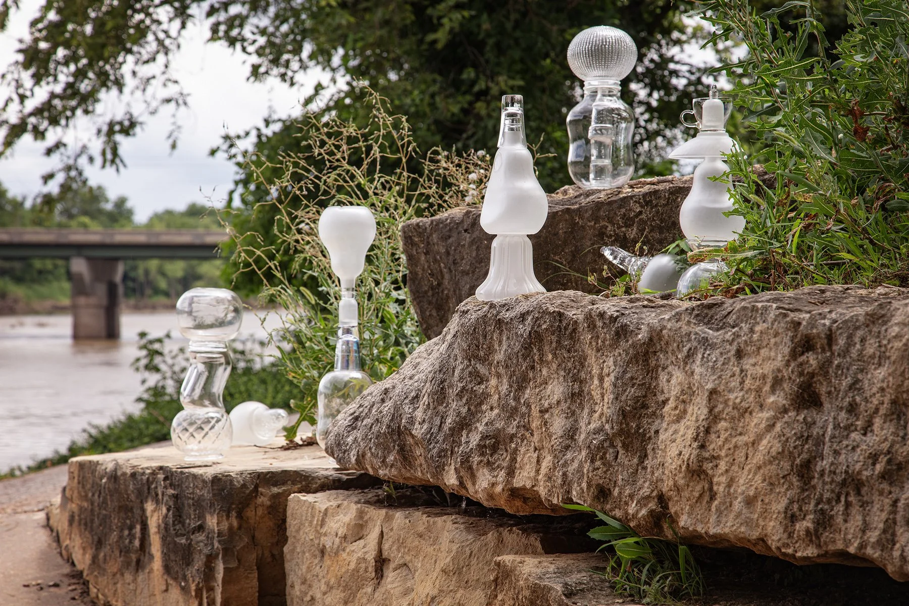
Oxford, Kansas, July 4, 2025
37°16'34"N 97°09'45"W, Elevation 1,150 feet
Many small clear-and-satin-glass cairns rest on stone retaining walls at riverside. The Arkansas River Public Access boat ramp is out of view to the left.
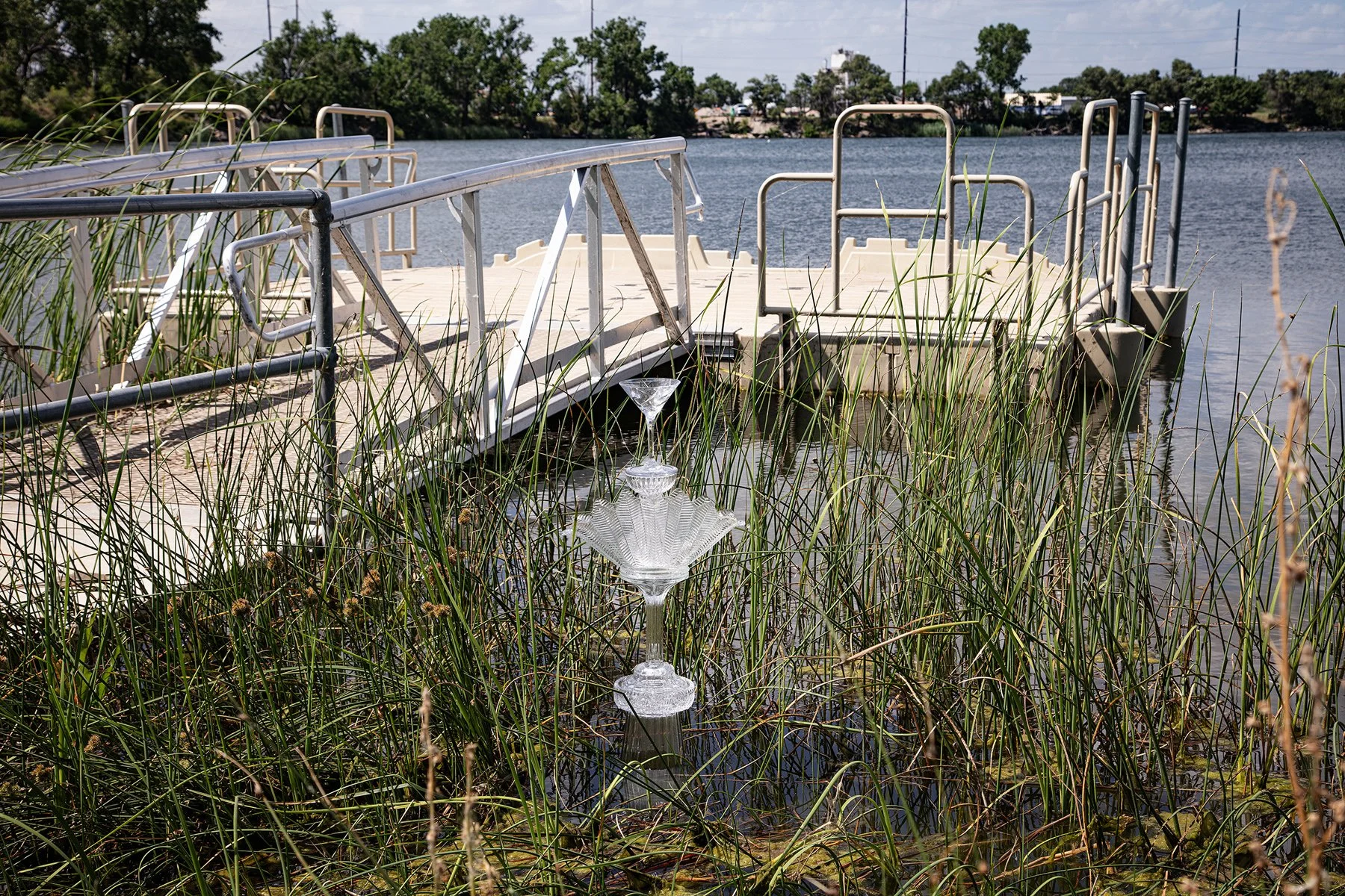
Arkansas River Access Site, South Washington and Railroad avenues, Great Bend, Kansas, July 3, 2025
38°21'02"N 98°46'25"W, Elevation 1,850 feet
Paddlers can enjoy 192 miles of scenic water trail and riparian corridor wildlife habitat along the Arkansas River from this dock in Great Bend, Kansas, to the Oklahoma border.
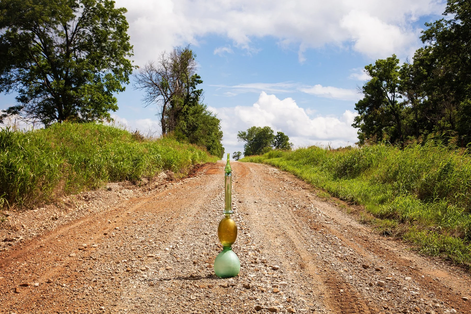
111th Road near Highway 22, Arkansas City, Kansas, July 4, 2025
37°0'41"N 96°56'58"W, Elevation 1,110 feet
This road near the border of Kansas and Arkansas is typical of the gravel roads the artists use to find interesting river views. Most roads will have trees on the river side and miles of agricultural fields on the other side. Watershed Cairns created an image near another Arkansas City, Arkansas, 506 miles southeast, near the confluence of the Arkansas River with the Mississippi River.
Jim P. Martinez Sunflower Trail, Hutchinson, Kansas, July 3, 2025
38°01'49"N 97°55'42"W, Elevation 1,520 feet
A sandy beach on the Arkansas River was just beyond these bushes. We could hear swimmers laughing and splashing.
Near Cow Creek, Lyons, Kansas, July 3, 2025
38°18'15"N 98°10'26"W, Elevation 1,640 feet
Small yellow flowers grow in the marshy ground next to Cow Creek, one of many smaller tributaries of the Arkansas River.
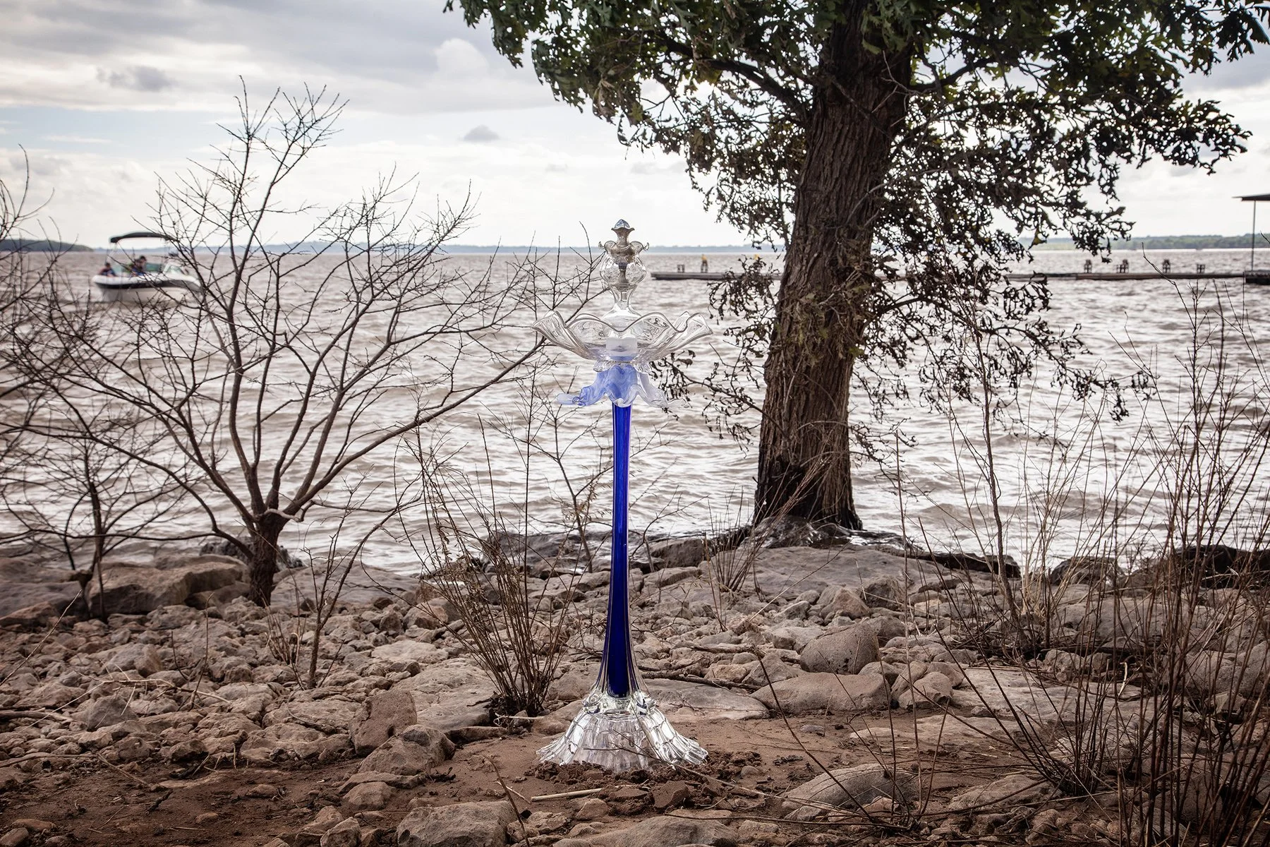
Marina, Pioneer Park, Kaw Lake, Kaw City, Oklahoma, July 4, 2025
36°45'26"N 96°51'28"W, Elevation 1,040 feet
To the right of this picture’s frame, a bustling marina saw dozens of boats filled with families and giant inflatable water toys coming and going. Some boats sailed up to us or walked by as we assembled the blue cairn and a waited for the sun to illuminate it, still, no one asked us what we were doing.
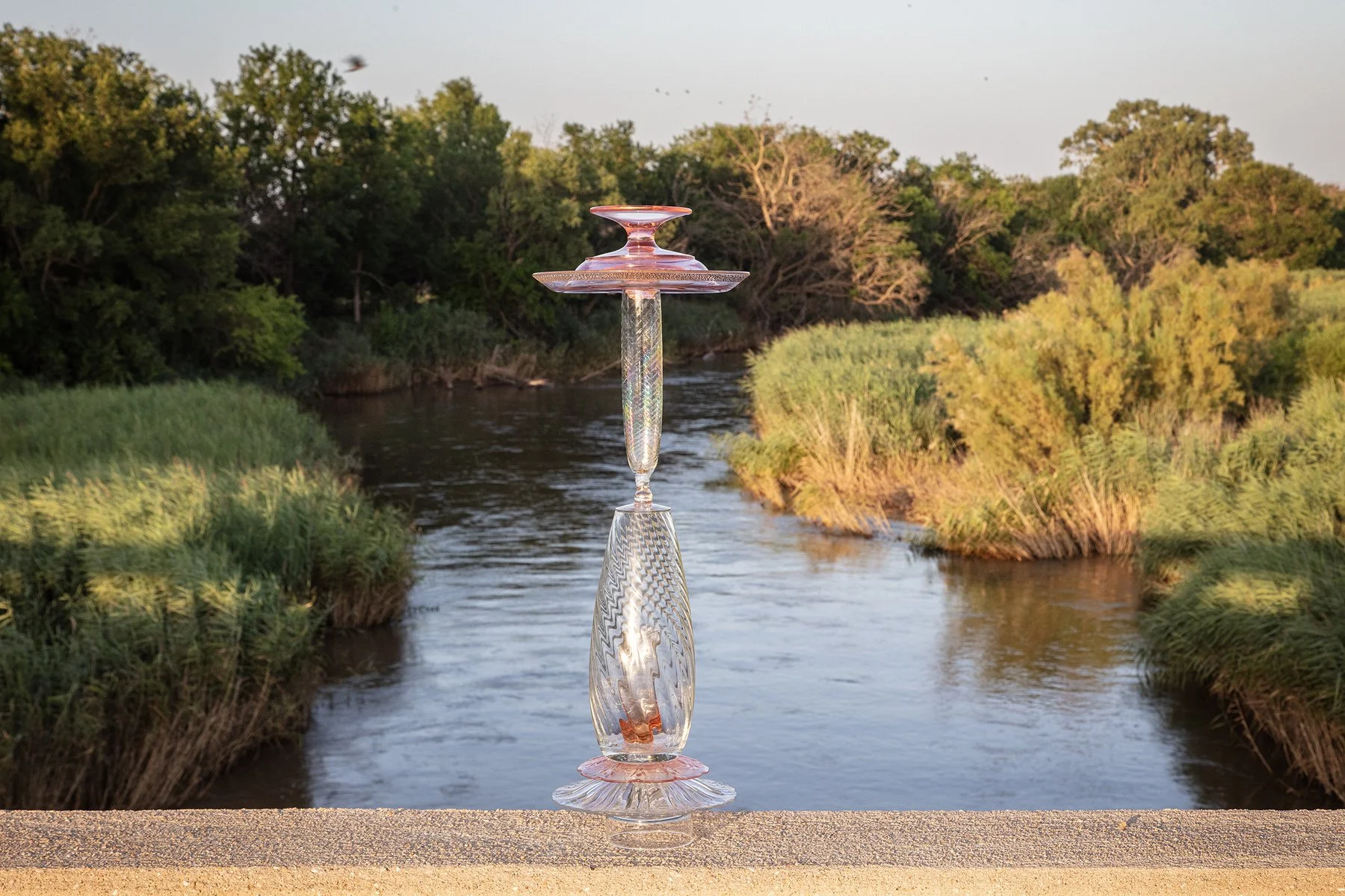
North 279th St. W, Mount Hope, Kansas, July 3, 2025
37°01'53"N 97°39'55"W, Elevation 1,440 feet
A delicate pink-glass cairn on this bridge over the Arkansas River reflects the setting sun.
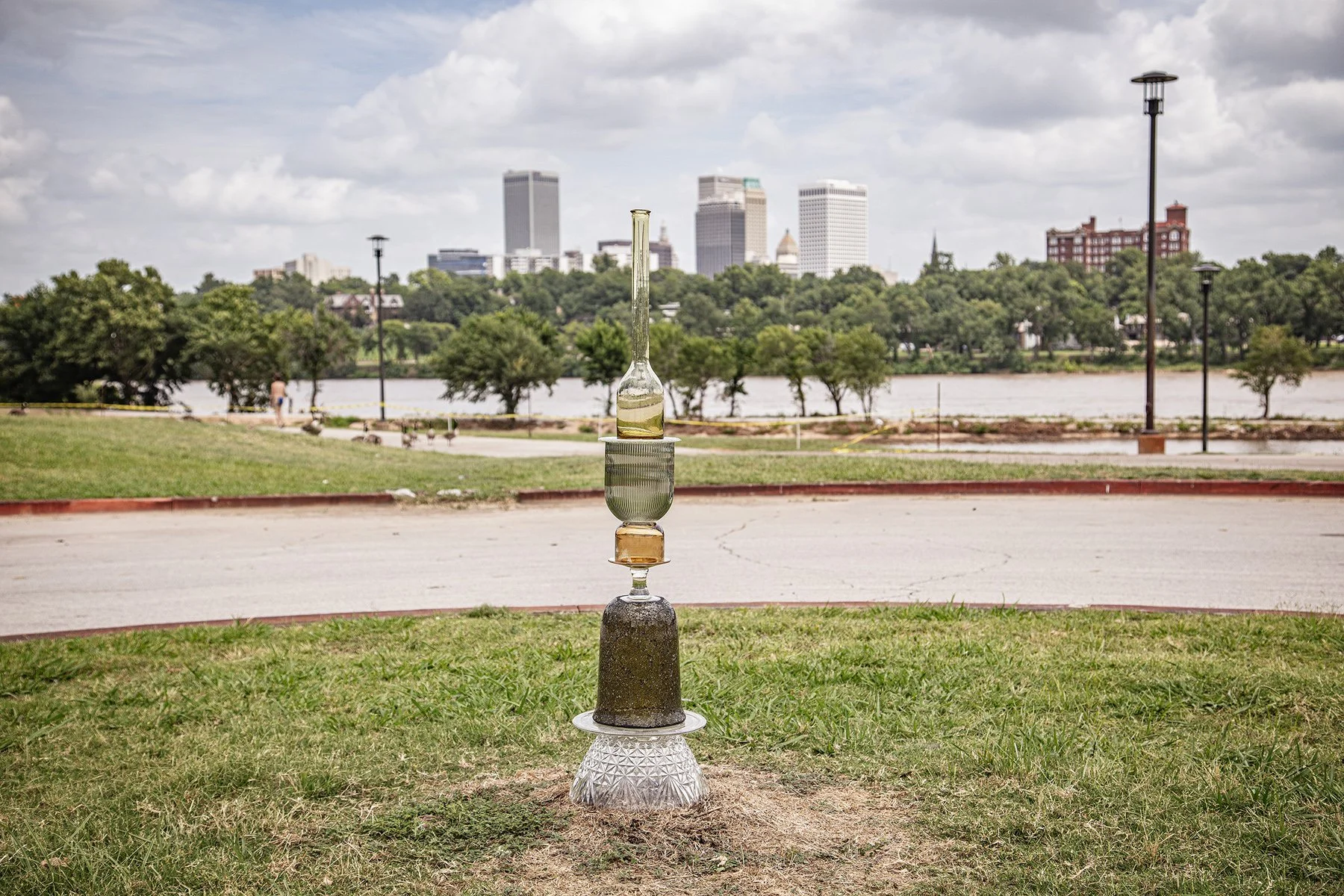
River Parks West Bank Trail, Tulsa, Oklahoma, July 5, 2025
36°08'08"N 96°0'0"W, Elevation 630 feet
Tulsa’s River Park, on South Jackson Avenue, overlooking the Arkansas River had been the site of the previous night’s Independence Day celebration.
Highway 18, Ralston, Oklahoma
36°30'20"N 96°43'24"W
Elevation 820 feet
E5A6495
This stacked bowl cairn sits on the Osage Nation Reservation, looking across the river to the small town of Ralston, Oklahoma. The Osage Nation includes close to 1.5 million acres that the Osage Nation purchased from the Cherokee in 1883 after native people were relocated from their homes east of the Mississippi River to accommodate settlers. Killers of the Flower Moon, a recent novel and film, tells the story of what happened when oil was discovered on this land.
Riverwalk dock, Douglas Avenue Bridge on West Douglas Avenue, Wichita, Kansas, July 4, 2025
37°41'09"N 97°20'38"W, Elevation 1,210 feet
After much of the Arkansas River’s water had been used for irrigation, reducing the river to a trickle, it has returned to its full flow. Compare this bridge image with the one at Garden City in western Kansas.
July 5, 2025
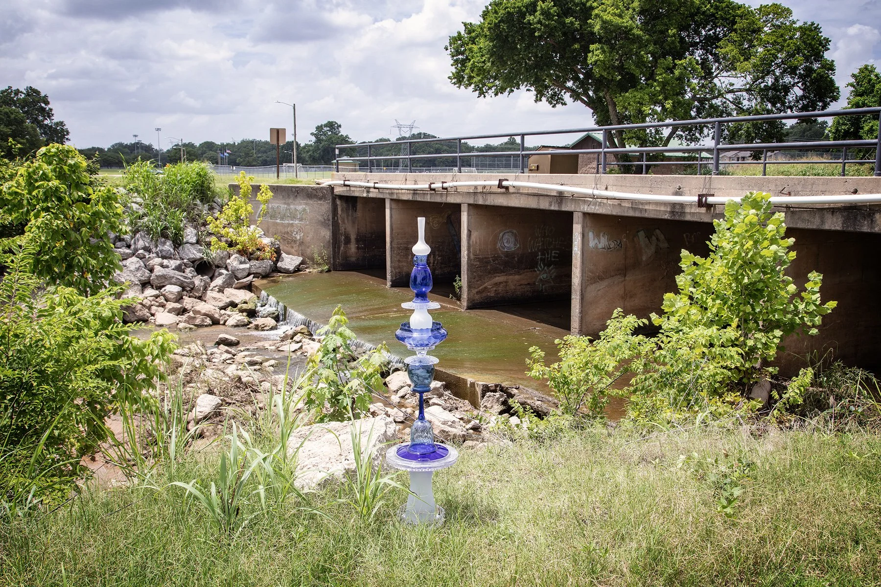
Indian Springs Sports Complex, Broken Arrow, Oklahoma, July 5, 2025
35°57'53"N 95°48'37"W, Elevation 570 feet
The Blue Splash Cairn sits near a spillway beneath a bridge connecting baseball, soccer, and softball fields.

Osage, Oklahoma, July 4, 2025
36°17'29"N 96°25'10"W, Elevation 750 feet
This crystal shell basket sits on the boat dock in Osage, “The little community by the lake,” and seems to capture some of the setting sun’s glow. The town on Keystone Lake, a reservoir created by the USACE dam on the Arkansas River, had a population of 176 in the 2020 census. A fictional Osage, Oklahoma, is the main town depicted in the 1930 novel Cimarron by Edna Ferber and the 1931 film based on it. Considered the first Western, it won three Academy Awards, including Best Picture in 1932.
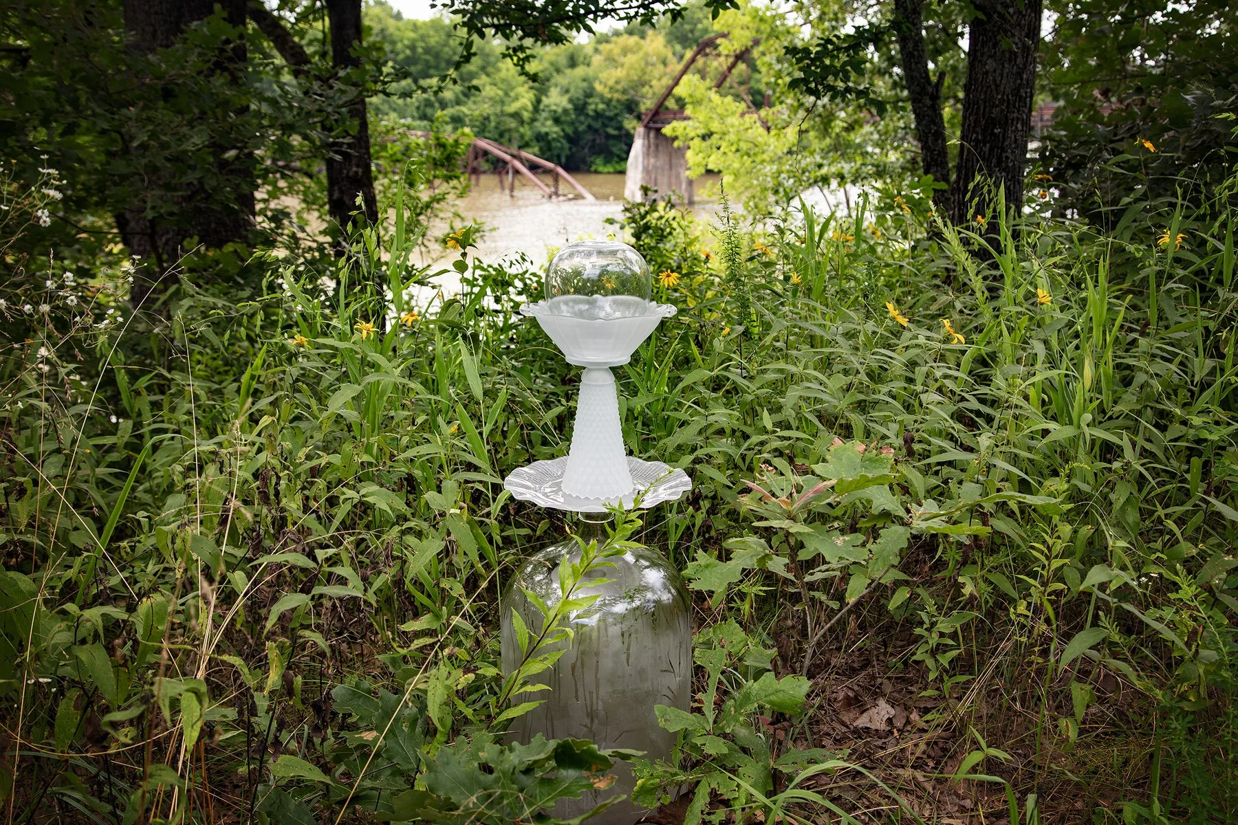
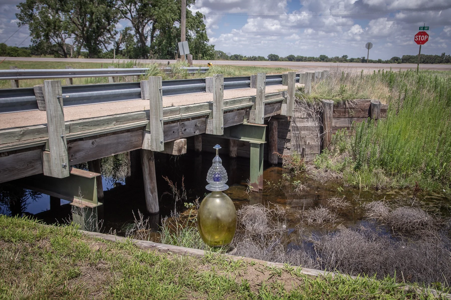
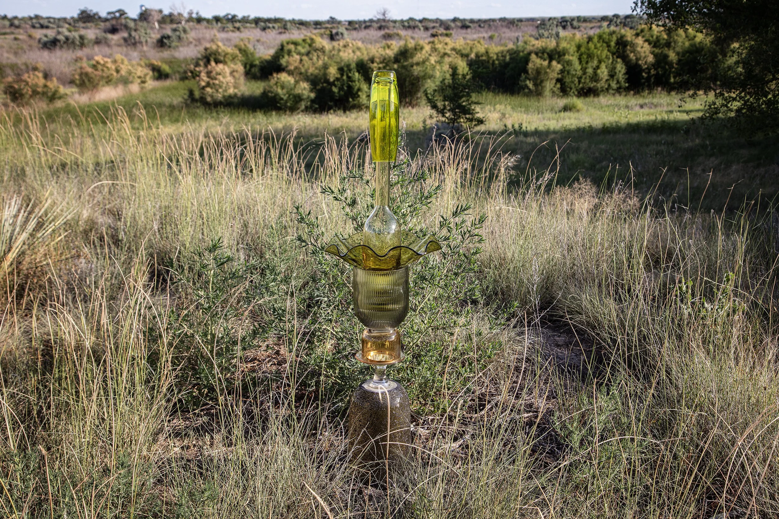
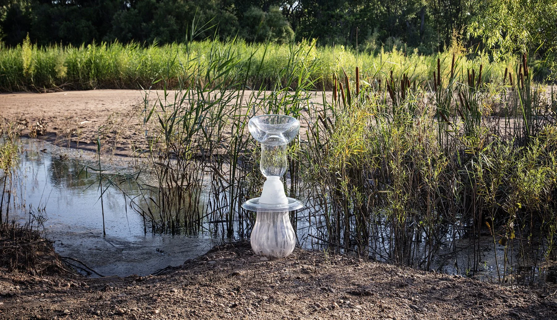
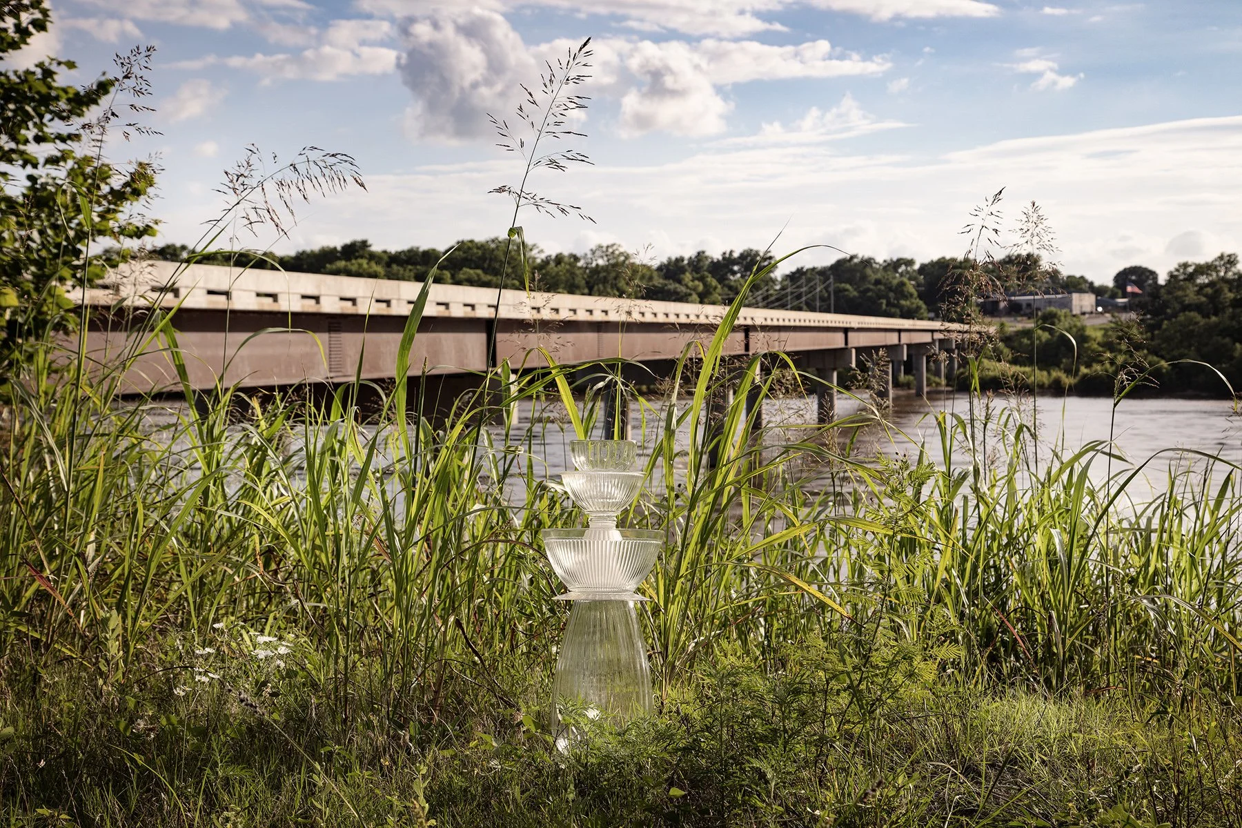
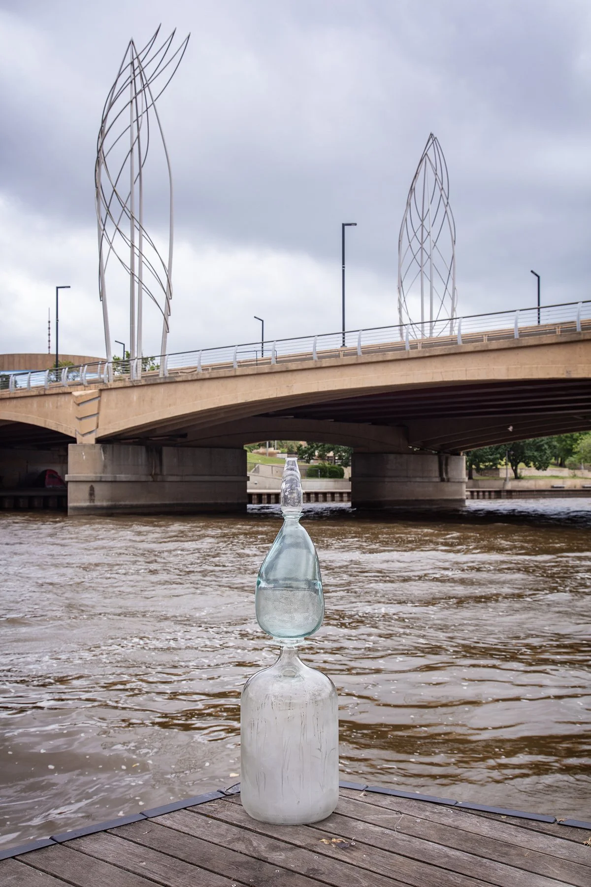
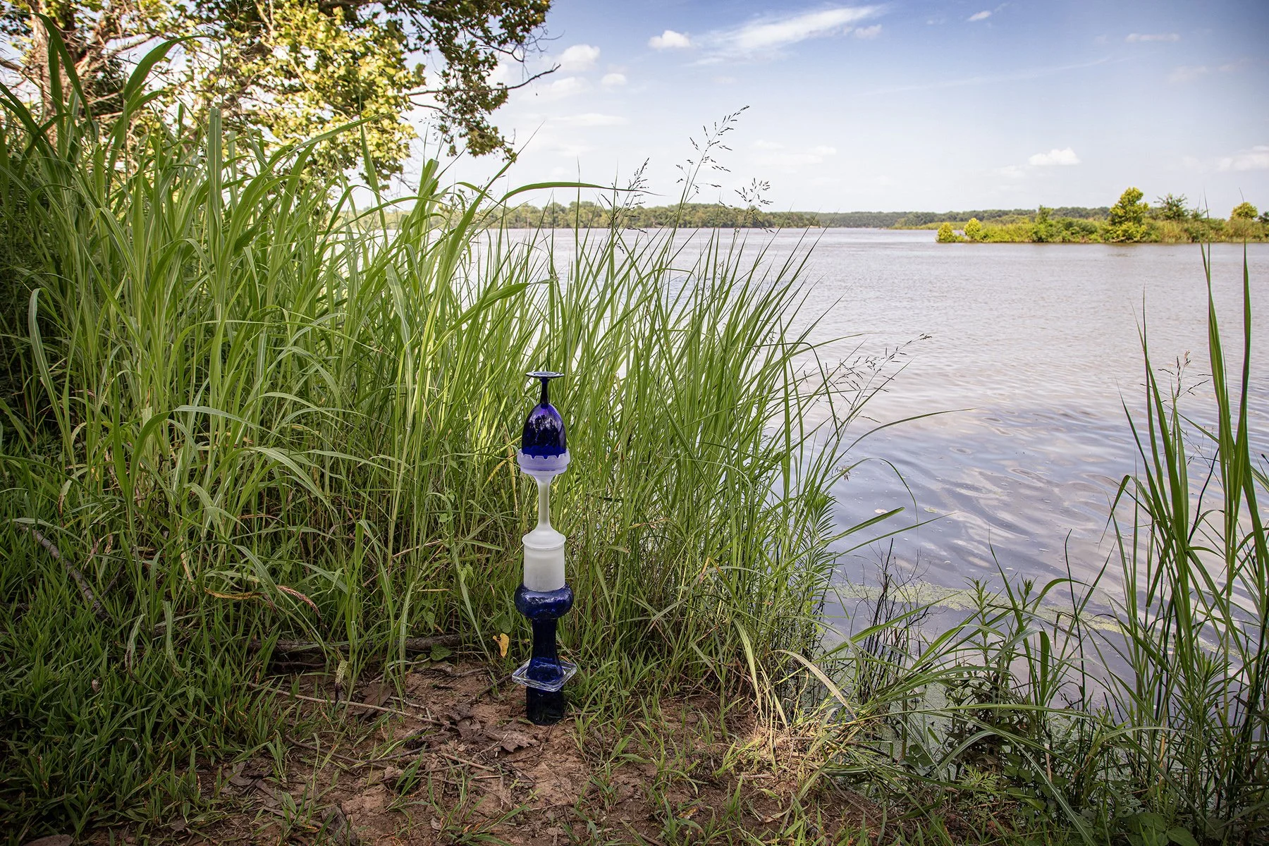
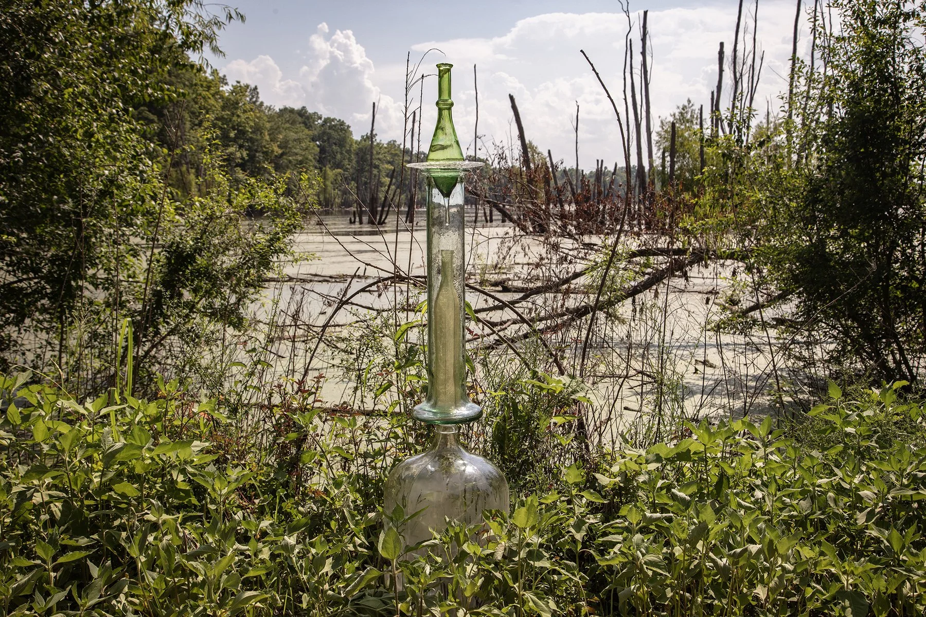
East 72nd Street north, Okay, Oklahoma, July 5, 2025
35°50'45"N 95°19'21"W, Elevation 510 feet
A five-gallon-jug forms the base for this cairn emerging from the grass and yellow flowers at the edge a backwater on the Verdigris River. A collapsed railroad bridge is partially submerged in the immediate background. A replacement bridge that doesn’t appear to be in use is visible between the trees on the right. The Verdigris River joins the Arkansas River north of Muskogee, Oklahoma, about three miles downstream.
White Water Recreation Area, Sand Springs, Oklahoma, July 5, 2025
36°08'53"N 96°15'09"W, Elevation 670 feet
The US Army Corps of Engineers Keystone Dam on the Arkansas River provides excellent fishing for humans and, if you look closely, a heron.
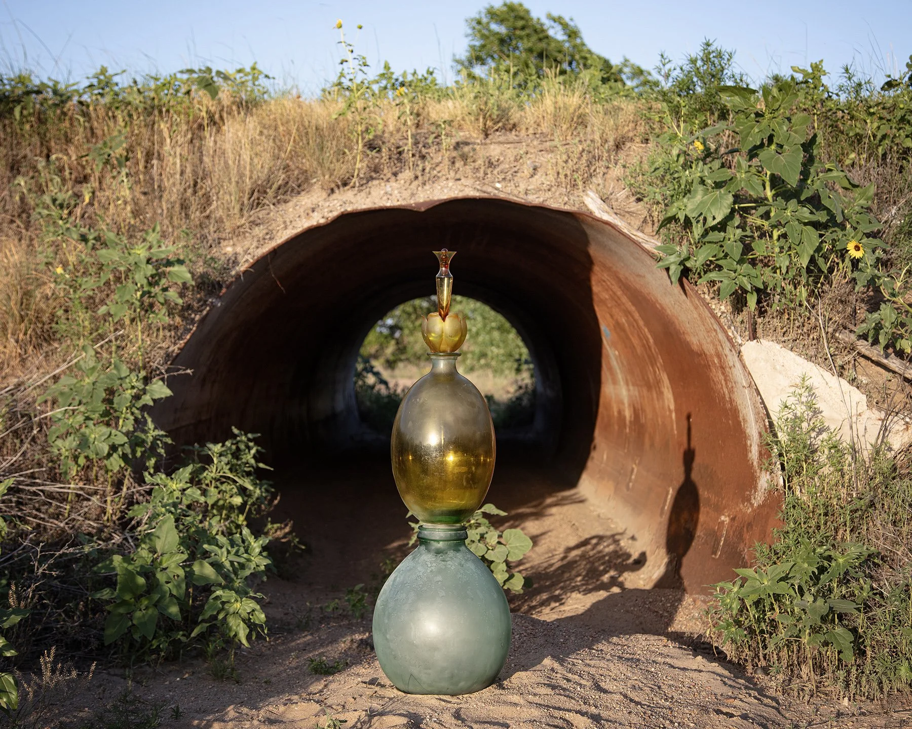
Unmarked road off 165th Street E in Sequoyah National Wildlife Refuge, July 5, 2025
Webbers Falls, Oklahoma
35°27'36"N 95°05'20"W, Elevation 470 feet
A small blue-and-white cairn sits at the edge of Dirty Creek as it enters the Arkansas
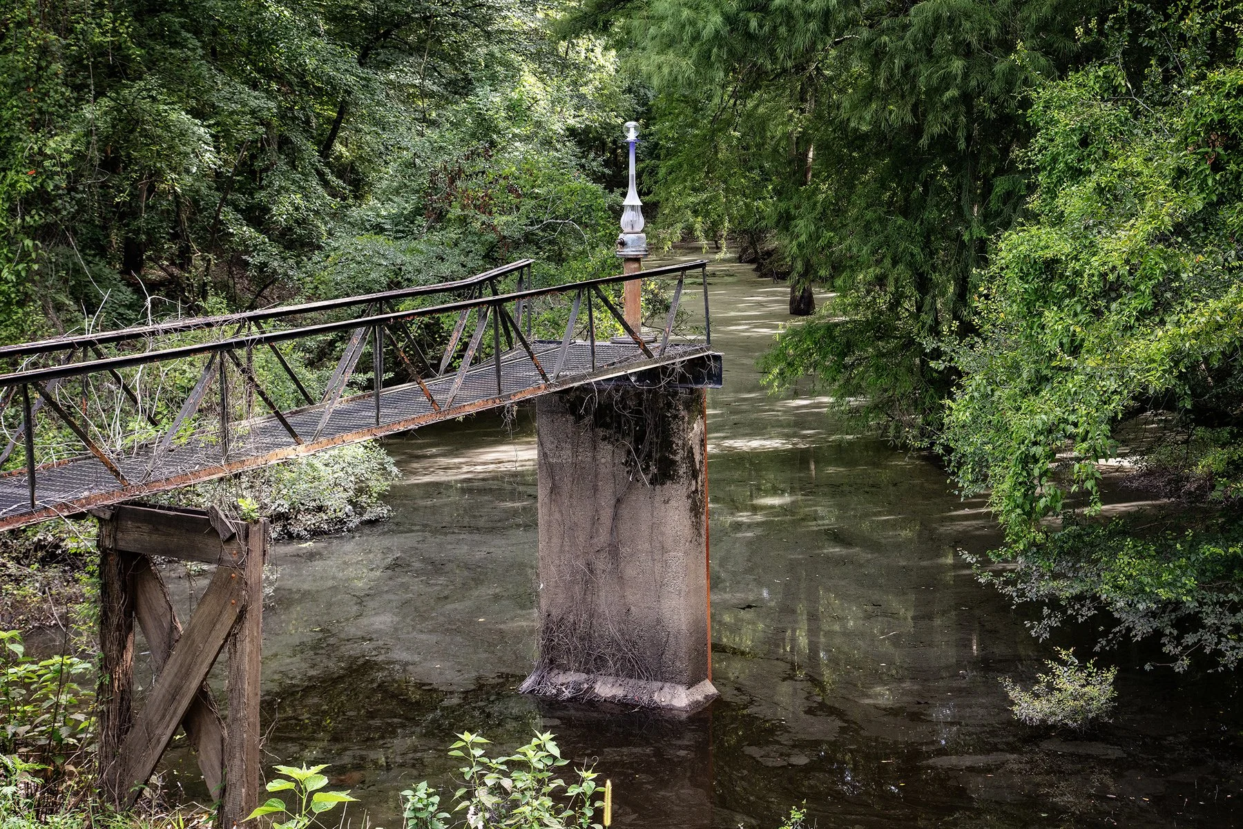
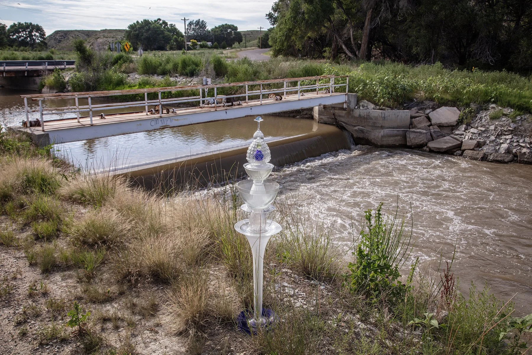
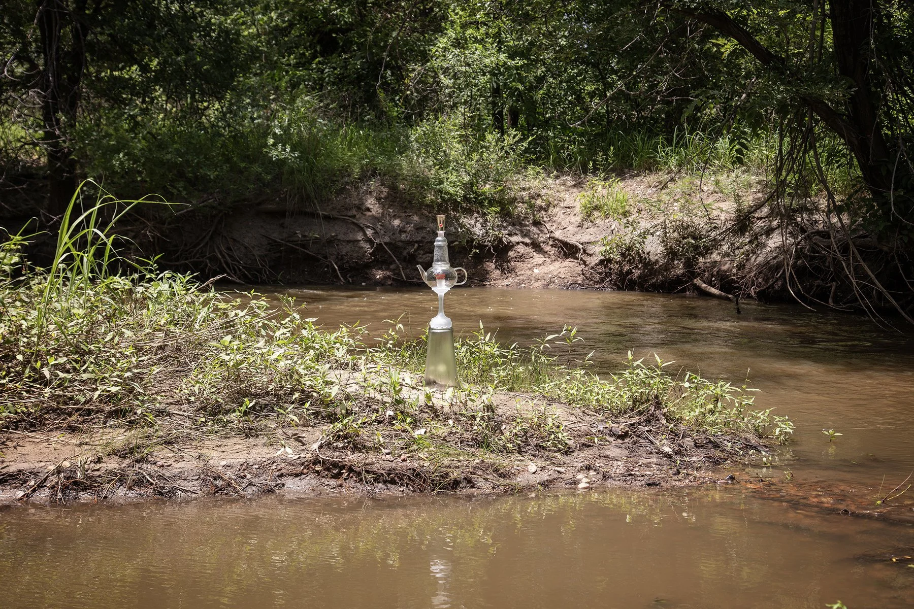
Fourche La Fave River, Cookie Ranken Road, Ouachita National Forest, near Perryville, Arkansas, July 6, 2025
34°59'41"N 92°46'52"W, Elevation 290 feet
A rusty metal bridge in a wilderness area of the Ouachita National Forest provides access to a steam-punk-looking water control valve that temporarily sports a white glass cairn. The national forest covering nearly 1.8 million acres was established by President Theodore Roosevelt in 1907 and named Ouachita (pronounced wash i tah) the French spelling of the Native American word meaning “good hunting ground.”
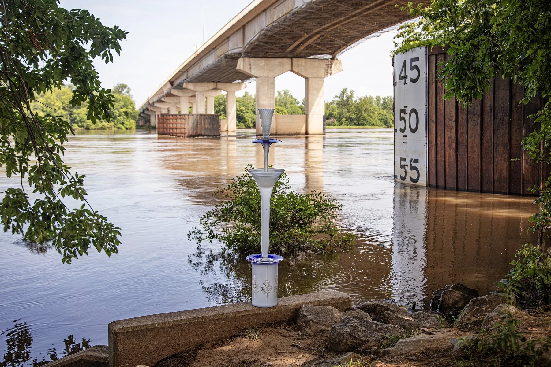
Belle Isle Park, Garrison Avenue, Fort Smith, Arkansas, July 6, 2025
35°23'28"N 94°25'53"W, Elevation 410 feet
Fort Smith was established in 1817 at Belle Point, overlooking the confluence of the Arkansas and Poteau Rivers. The Trumpet Cairn is standing on the edge of the Arkansas River below the fort. Discoverfortsmith.com states, “At Fort Smith National Historic Site, you can walk where Mexican War & Civil War soldiers drilled, pause along the Trail of Tears* and stand where justice was served to some of the most vile outlaws of The Wild West.” (*in 1830 the US passed the Indian Removal Act and used the army to force the migration of 12,000 Cherokee people from their land east of the Mississippi to the Oklahoma Territory.)
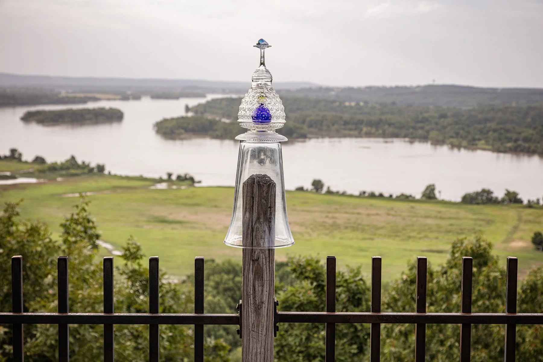
Pinnacle Mountain State Park, Little Rock, Arkansas, July 6, 2025
34°50'40"N 92°27'42"W, Elevation 500 feet
This wooden structure on the Fulk Mountains looks over the Maumelle River as it enters the Arkansas River and toward the Camp Robinson Wildlife Management Area.
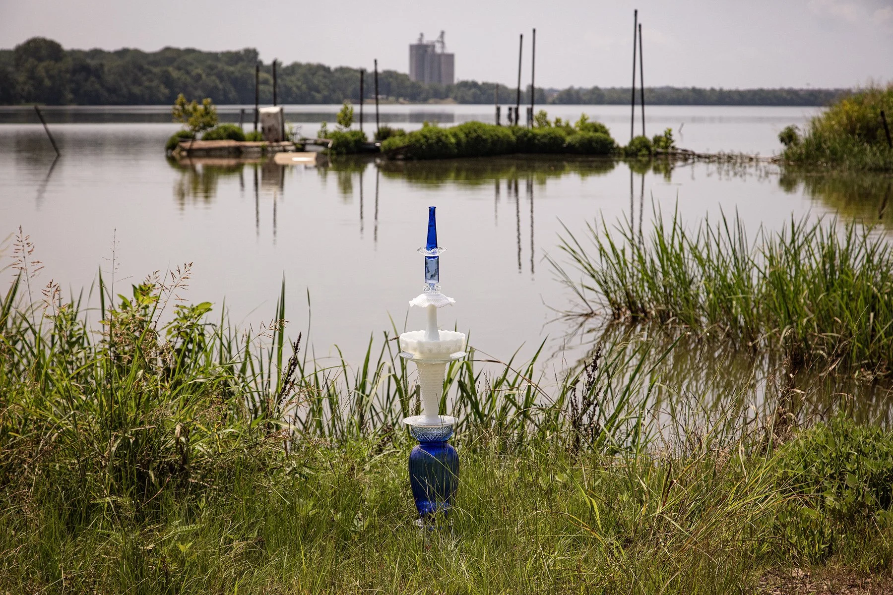
Island Harbor Marina Road, North Pine Bluff, Arkansas, July 7, 2025
34°17'01"N 91°56'53"W, Elevation 200 feet
At the end of the road on the narrow point of a peninsula between the Arkansas River and Lake Langhofer sits a blue-and-white cairn. The towering grain silos of Tyson Foods Feed Mill in Pine Bluff on the far side of the lake can be seen in the distance.
Aux Arc Park (South Park), Ozark Lake, Arkansas, July 6, 2025
35°28'41"N 93°49'19"W, Elevation 410 feet
Aux Arc is French meaning river bend. This campsite on the south side of the horseshoe shaped bend in the Arkansas River has a view of a water treatment plant across the river.
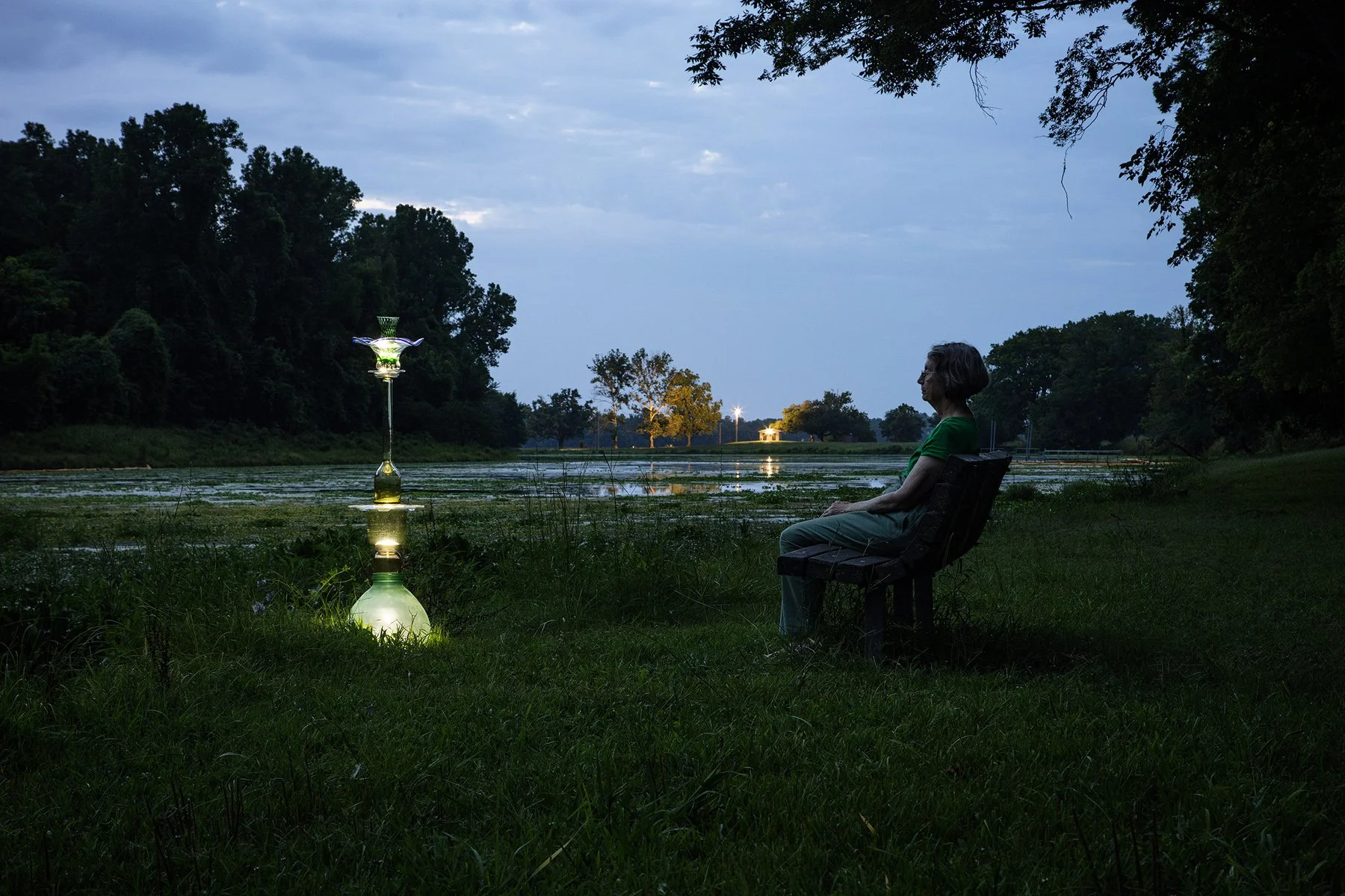
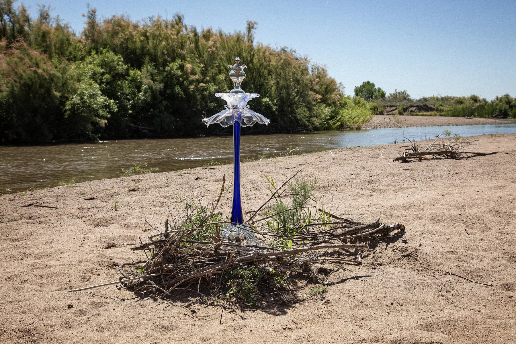
Blue Heron Parkway, Willow Beach Park, Little Rock, Arkansas, July 6, 2025
34°41'44"N 92°08'15"W, Elevation 240 feet
Artist Libby Reuter sits on a park bench at dusk in Willow Beach Park and Campgrounds while LED lights in the Flower Cairn and many biting insects compete for her attention.
Rising Star Road, Rising Star Campground, Grady, Arkansas, July 7, 2025
34°10'09"N 91°44'23"W, Elevation 190 feet
This bubble-like cairn, with a star engraved in the top, sits on a concrete and steel table next to a metal cooking grill in this public campground at the edge of the Arkansas River.
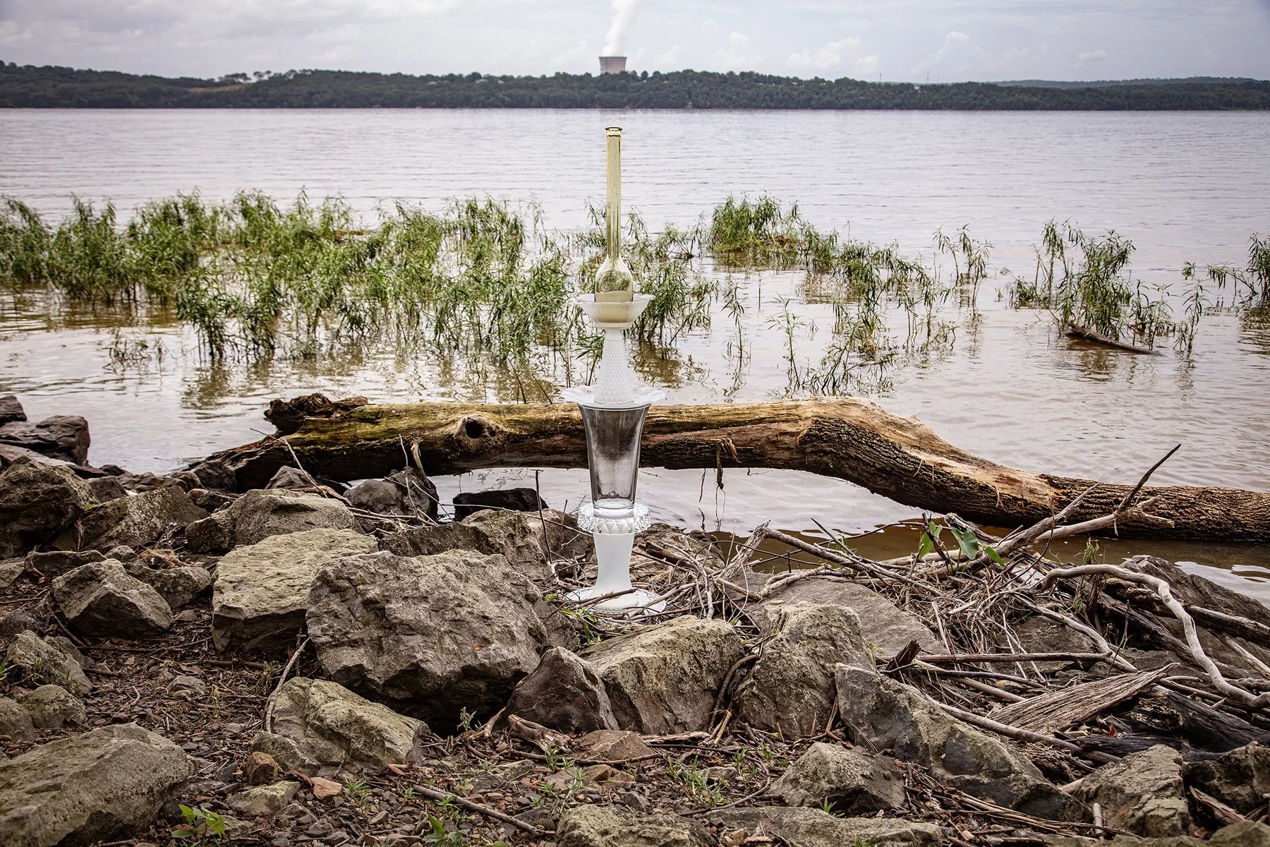
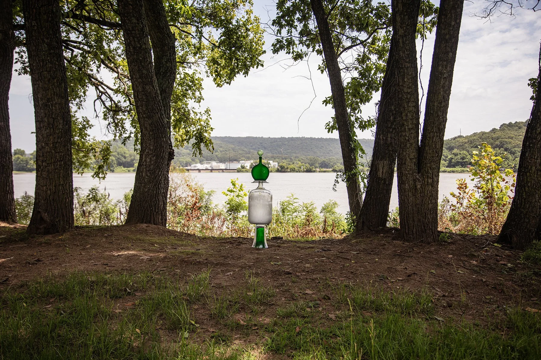
Lake Dardanelle State Park, highway 326, Russellville, Arkansas, July 6, 2025
35°17'19"N 93°12'23"W, Elevation 340 feet
This cairn points to the Arkansas Nuclear One nuclear power plant across the Illinois Bayou of the Arkansas River, near the town of London, Arkansas. The nearby Highway 64 bridge into Russellville is marked as a nuclear zone evacuation route.
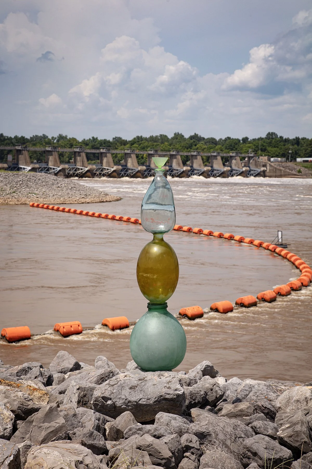
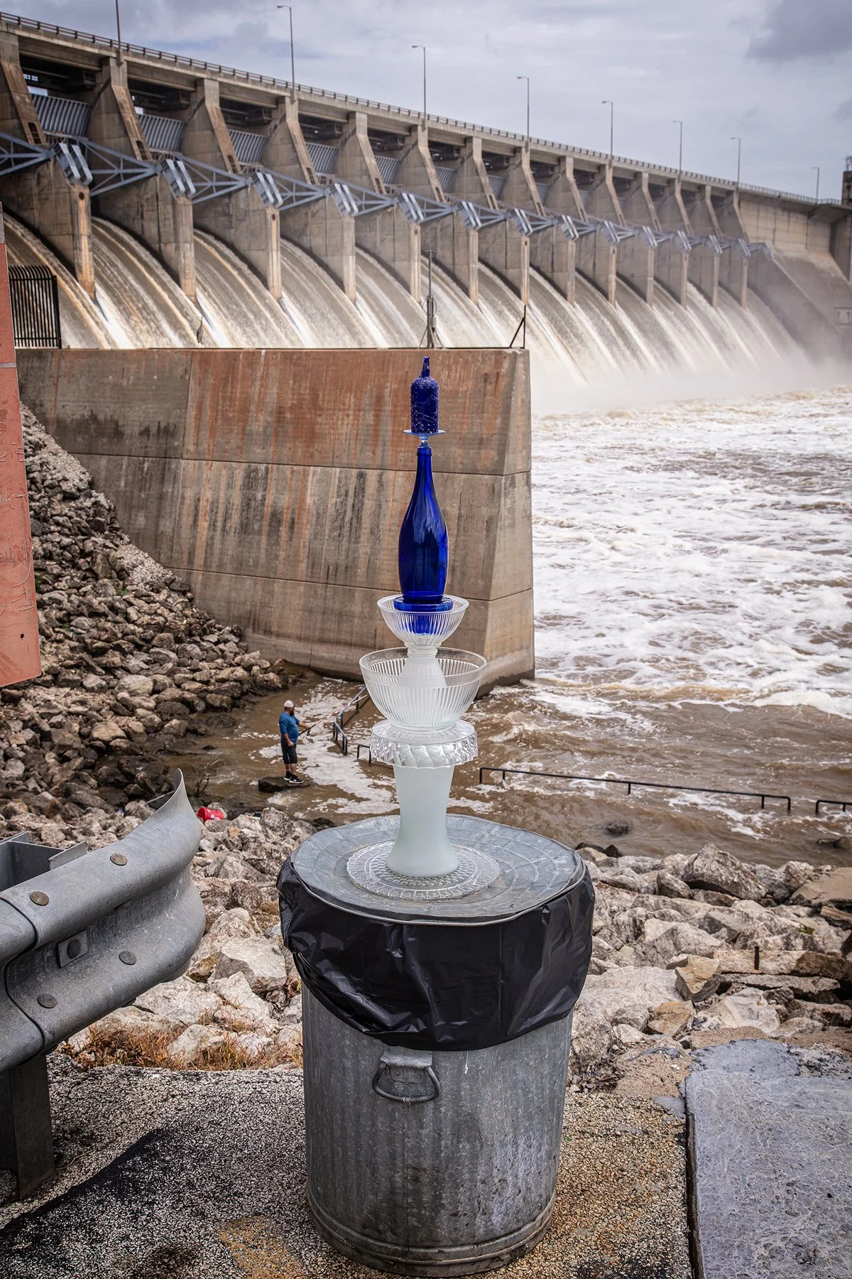
Hydroelectric Generating Station, near Pendleton, Arkansas, July 7, 2025
33°59'04"N 91°18'54"W, Elevation 170 feet
Three jugs, topped with a small green dish, are balanced on the rocks downstream from the Wilber D. Mills Dam. The string of orange floats cordon off the water coming from the Electric Cooperatives of Arkansas Hydroelectric Generating Station. The land across the river includes the Notrebes Bend Recreation Area and the Trusten Holder State Wildlife Management Area in the marshy delta between the Arkansas and Mississippi Rivers.
Highway 10 at the Great River Road, Rohwer, Arkansas, July 7, 2025
33°48'03"N 91°09'56"W, Elevation 150 feet
The Great River Road is actually a narrow gravel road on top of the levee. Farmers were harvesting hay on both the river and farm sides of the levee. Periodic cattle guards slowed our passage and probably prevented cows from wandering. At this site, we were very close to the official confluence of the Arkansas and Mississippi Rivers at 33°39'15"N 91°12'26"W.

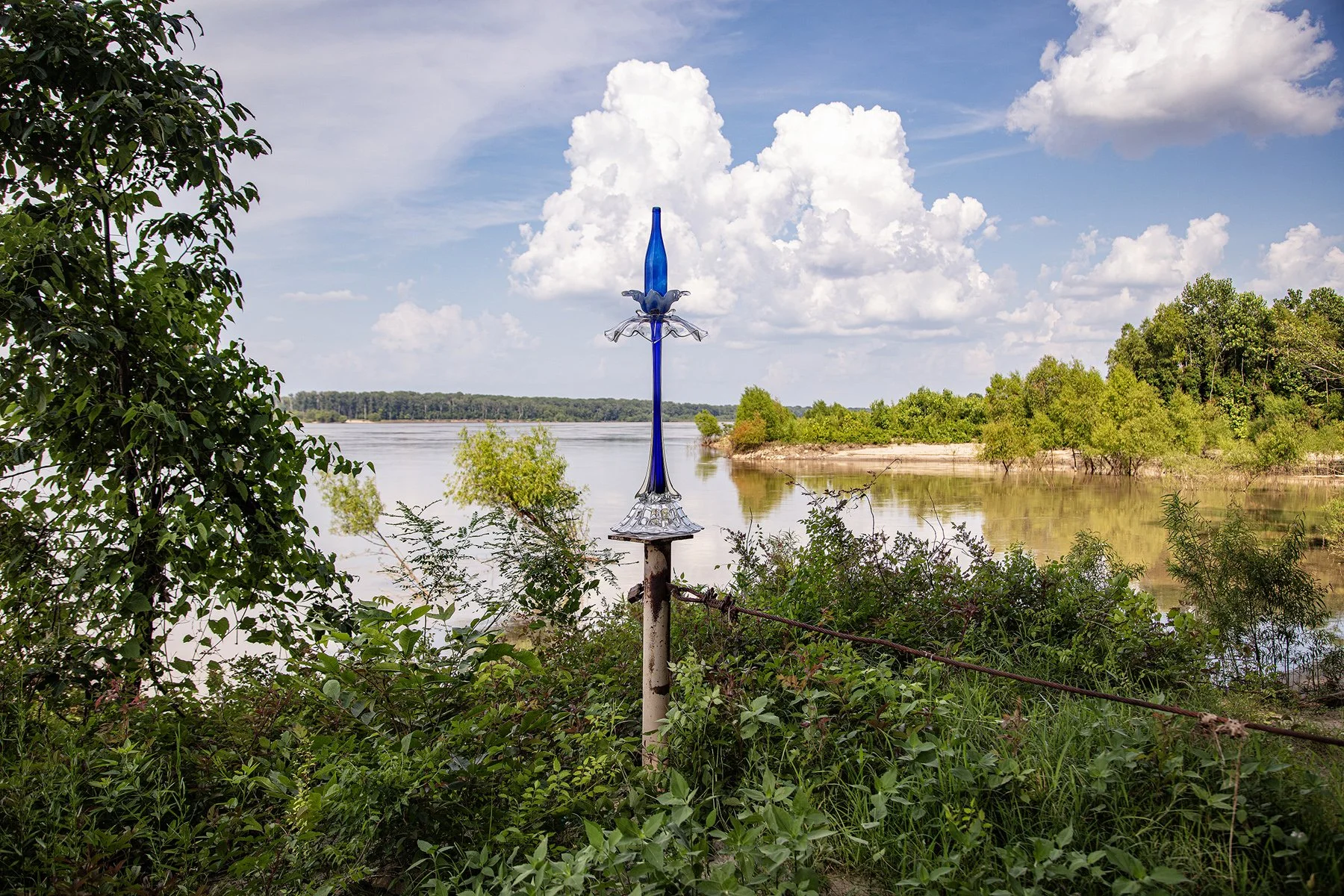
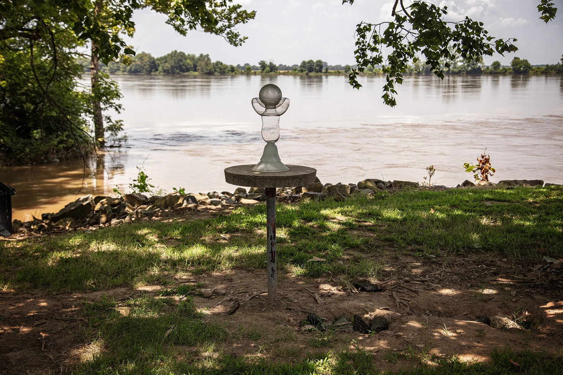
Highway 335, Governor Mike Beebe Scenic Overlook and Boat Ramp, Arkansas City, Arkansas
33°39'15"N 91°12'26"W, Elevation 140 feet
Because Arkansas City is frequently mentioned as the place where the Arkansas and Mississippi Rivers meet, we wanted to see if there was a way to get closer to the confluence. No luck. This image shows the Splash Cairn sitting on the fencepost where a heavy wire cable and lock prevent further access to the dirt road that might lead to the rivers’ confluence.

County Road 4S, off highway 50, Fowler, Colorado, July 1, 2025
38°07'56"N 103°59'42"W, Elevation 4,310 feet
This is another canal south of the Arkansas River. The canals are parallel to the Arkansas River, diverting river water to irrigate agricultural fields. Wikipedia states: “Water flow in the Arkansas River (as measured in central Kansas) has dropped from approximately 248 cubic feet per second (7.0 m3/s) average from 1944–1963 to 53 cubic feet per second (1.5 m3/s) average from 1984–2003, largely because of the pumping of groundwater for irrigation in eastern Colorado and western Kansas.”